British Columbia Parks and Trails

Planning adventures in our British Columbia Parks and Trails

Parks, hiking trails, historic sites, heritage sites, rivers, lakes and natural areas in BC Canada

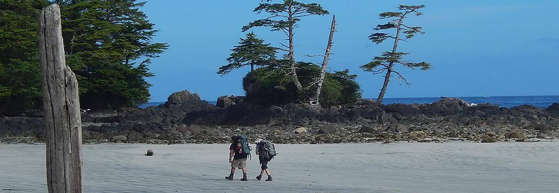
British Columbia parks and trails in Canada covers every type of landscape and seascape including mountain ranges, rivers, lakes, glaciers, forests, wetlands, wildlife, ecological and heritage. All play a big part in the creation of our BC parks system. Some of our BC Parks and heritage trails tells the long history of Canada. Others are for protection of wildlife, floral and fauna. Then there are those strictly designed for adventures and leisure living outdoors. There are over 11,400,000 hectares of BC parkland in Canada with over 2,700 kilometres of hiking and mountain biking trails.
British Columbia Parks & Trails

Over 800+ BC Parks in the province 

There are over 800 or so British Columbia parks in Canada. This, by no means, is the total number of wilderness and recreation parks in British Columbia, Canada as there are many others that do not fall under the Provincial umbrella. Other parks in the province includes a few National parks and many smaller community, regional, hyro and forestry recreation parks located throughout the province. Only 12.5% of our province is protected by BC Parks and 0.6% is protected by National Parks.

British Columbia Parks and Trails in Canada Summary

British Columbia parks and trails are used for many occasions and activities. The Khutzeymateen Provincial Park is Canada's only grizzly bear sanctuary. The Tweedsmuir Provincial Park is British Columbia's largest provincial park covering 989,616 hectares. On Vancouver Island the 440 metre Della Falls in Strathcona Park is Canada's highest waterfall and is one of the ten highest falls in the world!

Parks are an important part of our province providing thousands an opportunity to enjoy the wilderness outdoors. It is said 6 out of 10 people living in BC visit a park every year.

The British Columbia parks and recreation sites are here for yours and our tourism enjoyment. Please help us care for them and respect them. Do not leave garbage behind. Do not feed the wildlife. Always ask questions on the services, amenities, fees and rules to live by when in the park.

British Columbia Parks and Trails in Canada

Click the BC Regions below to view parks, trails and places in that area.

Cariboo Chilcotin Coast

Cariboo Chilcotin Coast Parks and Trails

Gulf Islands

Gulf Islands Parks and Trails

Haida Gwaii

Haida Gwaii Parks and Trails

Kootenay

Kootenay Parks and Trails

Lower Mainland

Lower Mainland Parks and Trails

North BC

North BC Parks and Trails

Okanagan

Okanagan Parks and Trails

Sunshine Coast

Sunshine Coast Parks and Trails

Thompson Shuswap

Thompson Shuswap Parks and Trails

Whistler Area

Whistler Region Parks and Trails
lostlake
Lost Lake is a trout lake. Most fly fish when on the lake. Be aware there is limited shoreline for casting. Belly boats and hip waiters work best on this lake. It is possible to hike in a canoe if fitness levels are good.
Read more
Beaver Lake Road
Winfield
kayaking-copeland
Kayakers usually plan a visit after launching from Lund on their way to the marine wonders of Desolation Sound. Scuba diving draws people to the area to explore the underwater reefs and marine activity as Copeland has many protected bays and sheltered inlets to explore.
Read more
Lund
hayward-mission
The lakes are recreation areas featuring man made reservoir lakes and BC Hydro Dams located north of Mission, British Columbia, Canada. Some of the summer activities include hiking, boating, fishing, swimming, mountain biking, canoeing, kayaking, boating, camping, sightseeing, sunbathing and picnic.
Read more
Hayward Lake Road
Mission
img_0781a
Cascade Falls Regional Park is located Northeast of Mission, BC, near the small community of Deroche.
Read more
Ridgeview Rd
Mission
hardyfalls6
Hardy Falls Regional Park is a hiking and sightseeing destination located on the south end of Peachland, BC, Canada in the Okanagan Valley. The waterfall park includes a salmon spawning river named Deep Creek and a well maintained hiking trail leading to the falls.
Read more
Hardy Road
Peachland
erickson_beach 002
The pebbled beach is a popular destination for watching sunsets and sunrises, as well as, swimming and sightseeing.
Read more
Van Anda
walter-wright-village-main_street
The village is a collection of buildings, artifacts and stories dating back to the early 1900's providing a quick glimpse into the lives and hardships of the early pioneers, miners and trappers.
Read more
Highway 97
Dawson Creek
bourbor_falls02
Bourbor Falls Trail in Tumbler Ridge, British Columbia, Canada is a short 800 metre path connecting to a cliff side viewpoint looking out over a river at Boubor Falls. The 1 hour return hike provides a great opportunity to view a towering waterfall without a long, hard hike.
Read more
Murray River Forest Service Road
Tumbler Ridge
sunken_gardens08
A small two level park with a short pebbled walkway leading through a tunnel into an open area surrounded by brick walls fronting floral gardens.
Read more
1st Ave
Prince Rupert
moricetown-rapids01
Moricetown Canyon is the home of the Wet'suwet'en First Nation people - one of the five First Nation communities located on or near Hwy 16. The main attraction is the Bulkley River, the Morice Canyon, the fish ladders and the wooden fish huts used for fishing.
Read more
Highway 16
Smithers
valley_trail_rainbow_park 003
The pathway acts as a transportation link connecting various parts of the community together accessed by hikers, walkers, bikers, roller bladders, joggers, dog walkers, xc skiers and snowshoers.
Read more
Whistler
steelhead-houston-fly_rod01
Home to the the "World's Largest Fly Rod", gardens, water fountain, playground and some information boards about the community of Houston BC.
Read more
Highway 16
Houston
green-timbers-park-220
Green Timbers Urban Forest is a protected area outfitted with a network of recreation trails, a lake, meadow, wetland and the Surrey Nature Centre. The activities enjoyed in the natural forest include hiking, walking, birdwatching, jogging, fishing and sightseeing.
Read more
100 Avenue
Surrey
alaska_bros-mile001
Alaska Highway from Dawson Creek to Fort Nelson in British Columbia, Canada. It is a total distance of 482 kilometres (300 miles). It is a forested route with rolling hills, mountain views and possible wildlife sightings.
Read more
Alaska Highway
Dawson Creek
dyke-abbotsford
The trails are activity trails which explore the farmlands, in and around, the community of Abbotsford, BC, Canada. The trails follow raised dykes including the Arnold (7.3 Kilometres), Vedder and Sumas River (8 kilometres), Borrowtown (4.5 kilometres) and the Mackay (1.5 kilometres). They are popul
Read more
Arnold Road
Abbotsford

Recently Visited BC Parks

Cadboro-Gyro Park
Cadboro Bay Village

Cadboro-Gyro Park is an oceanside park in the dist...

Alex Dobler Salmon Centre
Powell River

Nestled just off of the Sunshine Coast Hwy on your...

Rithet's Bog Conservation Area
Broadmead

Rithet's Bog Conservation Area is a natural park a...


Hiking With Your Children - Canadian Rockies Family Hiking Guide

Parks & Trails Map

Explore British Columbia
Wells Gray Golf & RV Resort - British Columbia, Canada
Find what Birds to Look For in this Park

Come Experience the Nicola Valley!