

Join Us
Join Us


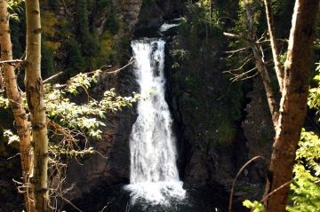
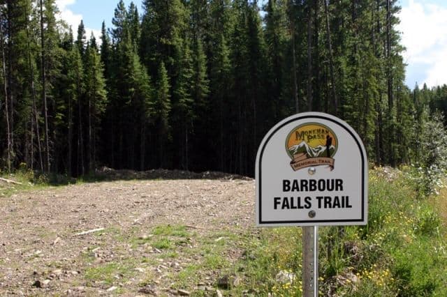
Bourbor Falls Trail in Tumbler Ridge, British Columbia, Canada is a short 800 metre path along a flat, easy grade path connecting to a cliff side viewpoint looking out over a river at Boubor Falls. The 1 hour return hike provides a great opportunity to view a towering waterfall without a long, hard hike.
The trailhead location to the Boubor Falls Trail is 38 kilometres from Tumbler Ridge in an area of waterfall hiking trails including Nesbitts Knee Falls and Kinuseo Falls in Monkman Park.
The Boubor Falls Trail explores a forest until the end of the trail when you reach the gorge and the cliff side viewpoint. The very short route follows, mostly, a pine needle cushioned trail with some exposed tree roots. The trail is suitable for all ages and is in bear country, so make noise and hike in groups.
The viewpoint at the end of the trail provides views of the waterfall from across the canyon. The viewpoint is perched on a forested cliff side with little barrier or fencing protecting people from the edge. Please do not let children run ahead of your group to the viewpoint on this trail.
It is a very steep drop-off from the viewpoint. Although, looking closely you can see some unauthorized paths heading down to the creek level. These are not recommended as it is very dangerous. Remember what goes down must come up and coming up from the creek would be a real huge climb for most.
Address:
