
Join Us
Join Us


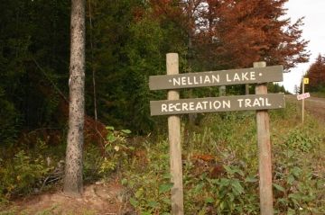
The hike was first used by the First Nation people as a trading route between villages. Today, the hike is used as a recreation route by hikers, horseback riders and fishermen heading out to Nellian Lake, the Fraser River and/or the Skeena River. Some complete the entire trail and connect to Pinkut Lake and the Ethel Wilson Park on the northeast end of the trail.
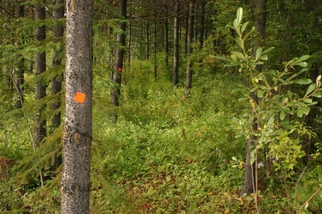
Although the 15 kilometre trail is an easy-grade, one-way trail it is long and takes up to 4 -7 hours to complete. The forest trail is lined with mainly pine and spruce trees and the underbrush and the regeneration of the forest sometimes infringes on the trail. It can get pretty muddy on this route in sections during some seasons.
The Nellian Lake Trail was first created as a trading route connecting the First Nation Villages of the Wet'suwet'en people (House of Tsayu Namox - Beaver Clan) and the Ne'duten people (House of Guis ta Gil Lantan - Caribou Clan). The arrival of the Grand Truck Railway and the fertile farm fields surrounding Burns Lake attracted the European settlers to the region.
In the winter time the settlers would work for the railroad for extra income. The pine trees in the Nellian Lake region were ideal for the railway ties. Every year until the late 1940's men would cut ties from the trees. And... every year men would have to travel deeper into the forest building "tie hacker cabins" along the route for accommodations during the winter months.
Today remnants of the cabins and forestry mill sites are still evident along the trail although the remains are worn down by nature. Two cabins are located on the west side of Nellian Lake and one is located close to the Palling Road trailhead. There are pine plantations near each trailhead and a scout camp on the west side of the lake with picnic tables. The backcountry route is situated in deep wilderness country so there may be an opportunity to view some wildlife while enjoying this hike like bears, deer and moose.
Address:
