


Join Us
Join Us


Murray Canyon Trail in Tumbler Ridge, British Columbia, Canada is a 3 kilometre one way trek (6 km return trip) located northeast of the community of Tumbler Ridge. The moderate hiking route provides explorers with far reaching canyon, river and mountain views. The route is an opportunity to view Murray Canyon while learning about the local flora and fauna.
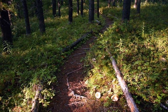
The Murray Canyon hiking adventure is suitable for all ages in good physical condition. The trail is lined with sitting benches at various points along the route just in case a rest is required. Overall, it is a relatively easy hike with some of the biggest challenges being the exposed tree roots, dead fall trees and boulders.. and the possible exposure to high winds on the south side of the canyon.
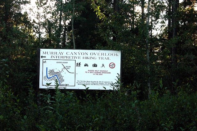
The trail is marked with numerous numbered signs. Each marker corresponds with a number in an interpretive manual available from the community (available at the Tumbler Ridge Tourism Office). The manual provides information about the local fauna and flora and provides the details about the local history and geography of the region while hiking the trail A play-by-play of the countryside.
The first half of the trail is 1.5 kilometres and leads to the first viewpoint. This portion of the hike is mostly exploring through forests. It is the better maintained of the two trail sections. The second half of the trail follows a wildlife access trail traversing under the rim of the canyon exposed to the elements. This section is not as well maintained due to the harsher elements.
From the parking lot the trail starts out exploring the flat forest terrain of the Kiskatinaw Plateau located 1000 metres above sea level. The trail carves a path through the forests consisting of, mostly, Lodgepole Pine, White Spruce, alder and willow. The forest floor is carpeted with feather and club mosses and spotted with Bunchberry, Labrador Tea, Arnica, Twinflower, Calypso and Fairyslipper Orchid flowers.
The trail then begins to climb at about the 1 kilometre point. Hikers will notice a difference in the surrounding vegetation and wildlife. There are more birds in the area including woodpeckers, thrashers and swallows. The trail continues its gentle climb to a notch leading hikers over the rim of the valley. Continue a little further and hikers reach the first viewpoint.
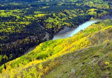
At the first viewpoint the scenery completely changes as the whole valley opens up in front of you. 1000 metres below is the Murray River and located across the valley one can see the peaks of Mount Bergeron and Mount Bennett. To your left is the Quintette, Roman and Babcock Mountains. In the far background is Castle, and Boone Taylor Mountains plus the peak referred to as Shark's Fin.
In the summer months the landscape changes colors from the wild flowers in the valley. The landscape is home to pea vines, wild roses, paintbrush, chickweed, pussytoes, Frog Orchids and Saskatoons. At the 2 kilometre point of the hike keep an eye open for the Golden Eagles. The area is also home to predatory birds like raptors and hawks.
The last kilometre of the hike is mostly following a trail of glacial till and sands. The path and surrounding cliffs is the evidence required to know that at one time a huge sheet of ice flowed through the valley during an ice age. A look across the valley provides the history of the valley told by the layers of rock in the cliffs. The trail ends at the viewpoint referred to as Sunset Point at the 3 kilometre mark.
Address:
