Gibsons
British Columbia
Canada
Difficulty: ModeratePark Amenities:
K2 or Knob Trail is also referred to as the Summit Trail by some. The intermediate hiking trail is a tough adventure including steep climbs and many intersecting offshoot trails like the Langdale Creek Trail. With many other trails in the area it is wise to pay attention to the colour markers outlining the routes of the trail network. pink markers in this case.
The Knob 2 hiking trail enjoys navigating the side of Mount Elphinstone (4,137 feet/1261 m) from the end of Wharf Road. Street parking only. Prepare well with water and good hiking boots, as it takes 2 hours one way, 4 hours round trip and that is not taking into consideration the long picnic many enjoy at the summit. It must be the captivating views of Howe Sound, Vancouver mainland, Britannia Mountain Range and parts of Vancouver Island that extend the trip time.
The K2 or Knob Trailhead is off of the Port Mellon Hwy, north of the Langdale ferry terminal on to Wharf Road. Start walking the road to the powerlines and turn left. Look for dirt road and hike it uphill past a tight U-turn. Start looking for Langdale Creek Trail (blue markers).
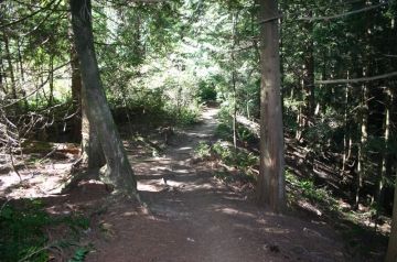
Take the trail through forest and when it starts to climb again look for the pink markers to the right. Take this pink trail and climb until it levels out at the top. Start downhill on the pink trail to the junction. The trail narrows and continues leading to Hutchinson Creek. The trail climbs again through some forest cover and eventually arrives at the summit.
K2 (Knob 2) Trail, Gibsons, BC, Sunshine Coast, British Columbia, Canada
Address:
K2 or Knob 2 Trail
Wharf Road
Gibsons
Canada
How To Get ToK2 or Knob 2 Trail
:
How to Get Here: Follow Hwy 101 to the traffic lights and North Road in Gibsons. Continue down North Road for 1.9 km (mi.) toward the Langdale BC Ferry. From Langdale BC Ferry take a right and follow the Port Mellon Hwy to Wharf Road. At the end of Wharf Road is the start of the hike.
No reviews yet for K2 or Knob 2 Trail.