Making Snow Cream in Canada Making Winter Treats with Fresh Snow How do you make snow ice cream? It's super easy! I will share how we make our ice cream from fresh fallen snow below. With only 3 simple ingredients, there...
Unlocking Opportunities: Navigating Tourism and Economic Development Grants "You get one chance to securing grant monies for your project. Select the right grant writer has everything to do with your success." Touri...
EH Canada Marketing Group BC Grant Writing Tips The Best Grant Writers in British Columbia have high success rates in obtaining funding and in project management. Top Tips for Finding the Best Grant Writers in British Co...

 Riverside Trail


Print
riverside001
Whistler

Trail Length: 6.3 kilometres

Difficulty: Moderate
Park Amenities:
Fishing
Hiking
Mountain Biking


Riverside Trail in the Whistler Interpretive Forest in Whistler, British Columbia, Canada is really about two trails acting as one - The Riverside Interpretive Trail and the Lower Riverside Trail. Both trails combine to create a good hiking and mountain biking experience exploring over wooden suspension bridges crossing crashing rivers while navigating up to volcanic lakes and mountain views.

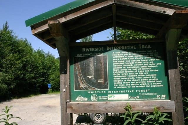
The first section - the Riverside Interpretive Trail - is a hiking-only 1 kilometre easy-grade trail following a well maintained earthy path into the forest. The route explores the trees with many interpretive signs posted along the way about the local forest and wildlife in the area.

Some of the trees in the interpretive area were born in the early 1700's. There are western hemlock, western red cedar and balsam trees in the protected buffer zone. Buffer zones protect stream banks, provide shade and produce litterfall (nutrients for fish falling from trees).

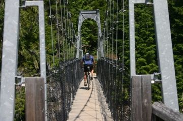
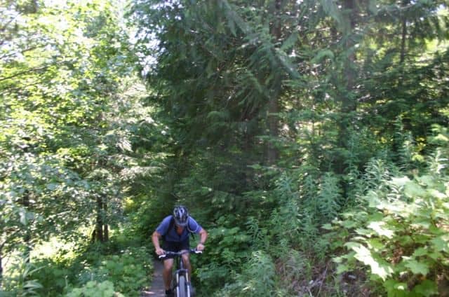
The second section - Lower Riverside Trail - continues from the interpretive trail further up the mountain. It is more about hiking, mountain biking and scenery from here on in. The trail is a mixture of gravel road and single - track routes connecting to other trails like the Farside Trail and Ridge Trail... plus it leads to Logger's Lake.

The Riverside Trail, along with the Ridge Trail, are the more popular hiking and mountain biking routes in the Whistler Interpretive Forest because they act as connector trails to other trails in the region.

From the Riverside Trail to the suspension bridge to Farside Trail Loop is 6.3 kilometres. The Riverside Trail to Loggers Lake is 3.5 kilometres. Riverside Trail to House Rock is 4.1 kilometres. All trail routes are multi use trails explored by both, hikers and mountain bikers. Each route is an opportunity to learn more about the wildlife, geological formations and forest types of the region.

Explore Riverside Trail in the Whistler Interpretive Forest in Whistler, British Columbia, Canada

Address:

Riverside Trail
Cheakamus Lake Road
Whistler
Canada

How To Get ToRiverside Trail

:
From Whistler, BC, Canada travel south on Hwy 99 (Sea to Sky) and take a left onto the Cheakamus Lake gravel road. Instantly, to your left, is a parking lot posted with trail billboards and distance maps. From here the Riverside Interpretive Trail begins.
No reviews yet for Riverside Trail.
Hiking With Your Children - Canadian Rockies Family Hiking Guide
Explore British Columbia
Find what Birds to Look For in this Park

Come Experience the Nicola Valley!