


Join Us
Join Us


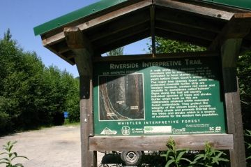
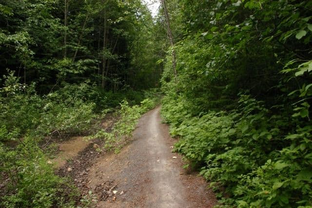
There is good selection of walking, mountain biking and xc skiing trails in Whistler, BC, Canada's Interpretive Forest that are suitable for all ages and fitness levels. The trails are, mostly well maintained, well marked with blue directional signs and are lined with interpretive signs.
The 3000 hectares (9000 acres) of forest is part of a grand network of trails and gravel roads that explore the southern backcountry mountains, lakes and rivers of the Whistler Valley. The trails are varied in scenery, difficulty and distance.
Along these Whistler, BC, Canada roads and trails there are blue trail distance signs and trailhead markers that clearly mark all the routes. Also along the roads and trails are interpretive signs about the local flora and fauna, rock formations and history. Whistler's Interpretive Forest provides an opportunity to learn more about the wildlife, geological formations and forest types of the region.
The vast trail network includes the Farside Trail, Ridge Trail, Crater Rim Trail, White Pine Trails, Craterview Loop Trail, Plantation Loop, Highline Trail, Discovery Loop and the Biogeoclimatic Interpretive Trail.
Some of the more popular Whistler, BC, Canada trails include the Riverside Trail which explores the Cheakamus River via crossing a suspension bridge. It is also a popular kayak put-in point on the river. The Loggers Lake Trail climbs a rock bluff to a hidden lake and a wooden pier. The Cheakamus Trail wanders through trees to a mountainous lake.
The Whistler Interpretive Forest is a popular destination for many who enjoy a good day of hiking, fishing, mountain biking, kayaking, snowshoeing and xc country skiing. It is nice that many of the trails connect leading deeper into the wonders of the backcountry.
Address:
