
Join Us
Join Us


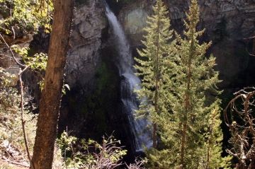
Nesbitts Knee Falls in Tumbler Ridge, British Columbia, Canada is a one-way 1.5 kilometre path (3 kilometre return trip) exploring through a forest along a narrow pine needle cushioned trail ending with peek-a-boo views of Nesbitts Falls on Waterfall Creek.
The Nesbitts Knee Waterfall Trail is only 39 kilometres south of the community of Tumbler Ridge, British Columbia, Canada. As an added bonus, it is close to some other well-used hiking trails and parks in the region like Boubor Falls, Monkman Park and the very popular Kinoseo Falls.
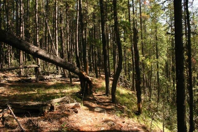
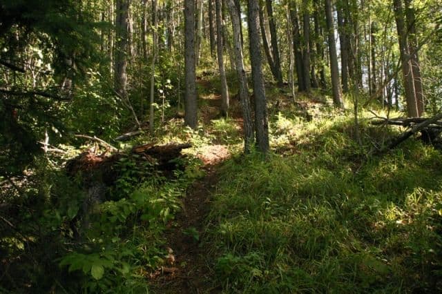
The Nesbitts Knee Falls Trail starts off uphill for a short distance and then levels out. From there the trail continues along a narrow path zig-zagging through the forest surrounded by dead fall trees. The exposed roots and boulders on the path provide the challenge. The squirrels darting across the path provide the entertainment.
Just prior to reaching the viewpoint is another small hill to climb. Once at the top of the hill the forest begins to open up and reveal the viewpoint and Nesbitts Knee Falls. Prior to the last hill leading to the falls, please keep children close and do not let them run ahead as the viewpoint is an open cliff with no barriers. Plus, this is bear country too.. so make noise and be aware of your surroundings.
The viewpoint is an open cliff (no barriers) overlooking a canyon. Below is Waterfall Creek and across the way is Nesbitts Falls. Viewing is, sometimes, interrupted by the tree cover and brush depending on seasons. The trail does scramble down the cliff to the base of the falls. It is a dangerous and slippery extension to the trail and should not be attempted unless you are physically fit and experienced. Remember what goes down must come up!
Address:
