
Join Us
Join Us


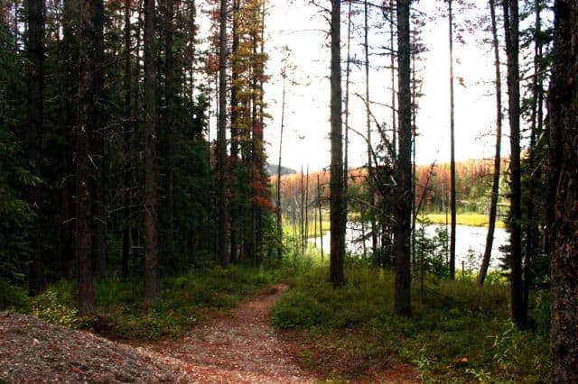
Stone Corral Trail in Tumbler Ridge, British Columbia, Canada is a beautiful wilderness hiking route exploring a forest, passing beaver dams, discovering fossils, exploring caves, stopping at viewpoints and wetland ponds. The 4.5 kilometre return hike should take no longer than 3 hours to complete. Although, please plan accordingly to allow some time to explore.
The Stone Corral Trailhead is located at the end of 63 kilometres of paved and gravel roads. The hike is located south of the community of Tumbler Ridge, British Columbia, Canada in the Monkman Provincial Park. It is a hiking adventure involving steep climbs, high cliffs, sinkholes and many dangerous sections. Families hiking with children should always stay close together.
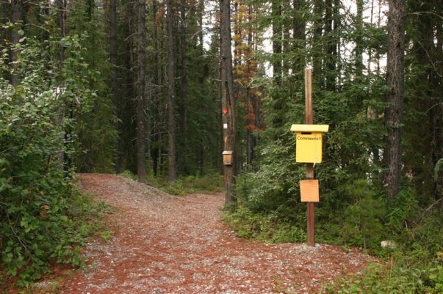
The trail is marked with numerous numbered signs. Each marker corresponds with a number in an interpretive manual available from the community (available at the Tumbler Ridge Tourism Office). The manual provides information about the local fauna and flora and provides the details about the local history and geography of the region while exploring along the trail.
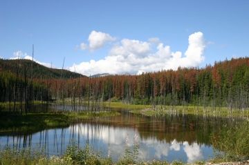
The Stone Corral trailhead entrance is opposite the Jade Falls trailhead which is located on the other side of the gravel road. The caving trailhead starts out from the gravel parking lot next to the wetland pond. There is a picnic table and some outhouses available in the parking lot.
Once hiking begins look for the first offshoot path to your right as it leads to a series of beaver dams. The gnawed off trees seen along the trail provide the signs of beaver activity in the area. At the end of the short side trail is a series of mounds made of sticks, mud, twigs and rocks resembling beaver dam homes. These dams created the lake that fills the Green Bowl (the body of water hikers have been walking beside).
The hike continues to follow the banks of the Green Bowl crossing over Monkeyflower Creek and Gentle Spring. The trail then begins to climb some stairs. Eventually hikers will reach a hanging limestone rock and a notch in Chambers Ridge. The trail continues through the notch and leads to the first and second ponds.
The hiking trail then leads to the Stone Corral which is a tarn consisting of a three massive cliffs. A destination worthy of stopping because of the views of the cliffs and the wonderful limestone formations. Look closely at the limestone rock located along the trail and on some of the side routes in the area and hikers will find fossils.
At the far end of the Stone Corral is Corral Cave. It is a 20 metre deep cave. Inside is a an example of a phreatic tube, flowstone walls, stalactites and moonmilk. From the Corral Cave the trail continues climbing to the first viewpoint. From the viewpoint hikers can see Monkman Park, Castle Mountain and Mount Watts.
Go back down the ridge and back onto the trail and continue to the next cave named Porcupine Cave. Along the path hikers will come across a sinkhole which is an entrance to the cave. The best entrance is the 2nd sinkhole. The cave is 10 metres long and connects the two sinkholes together.
Back on the trail and another viewpoint later it is time to head back to the main parking lot. The hiking trail from Porcupine Cave loops back and connects to the original main trail and eventually back to the parking lot.
Be aware the trail is in bear, cougar and moose country. Hike in groups. Make noises and do not let children run ahead on this trail.
Address:
