


Join Us
Join Us


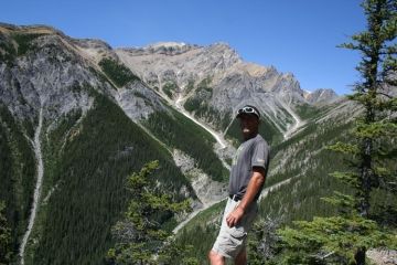
The Cory Pass Trail and the Edith Pass Trail located in the Banff National Park combine for one of the more difficult and more visual rewarding hiking adventures when exploring the Rocky Mountains in Alberta Canada. There are views of mountain vistas, mountain ranges, valleys of wildflowers, glaciers, wildlife, alpine lakes and plenty of time to reflect. Spell binding!
 Together, the Cory and Edith Pass Trails form an uphill 13 kilometre loop route exploring through mid mountain forests and alpine valleys, up and over mountain ridges and rocky cliffs and navigating switchbacks over rock slides and shale slopes of Banff National Park.
To reach the fantastic views will take allot of effort and good health. This Banff trail is no easy trek. The Cory Pass Trail includes an elevation gain of 915 metres (2925 feet) and the Edith Pass Trail includes an elevation gain of 520 metres (1690 feet).
Most hikers begin by going up the Cory Pass Trail and then back down on the Edith Pass Trail. Reason - the views on the Cory Pass Trail. The route should take between 5 -8 hours to complete depending on the size of the group, your group's fitness levels and how long you stay at the top. Best bet is plan the whole day on the trail and treat yourself with a picnic at the top.
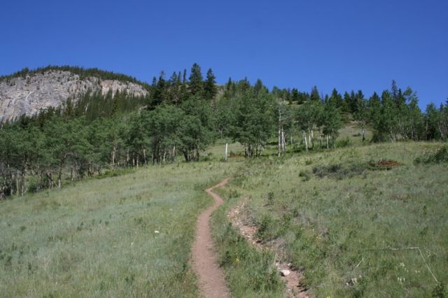
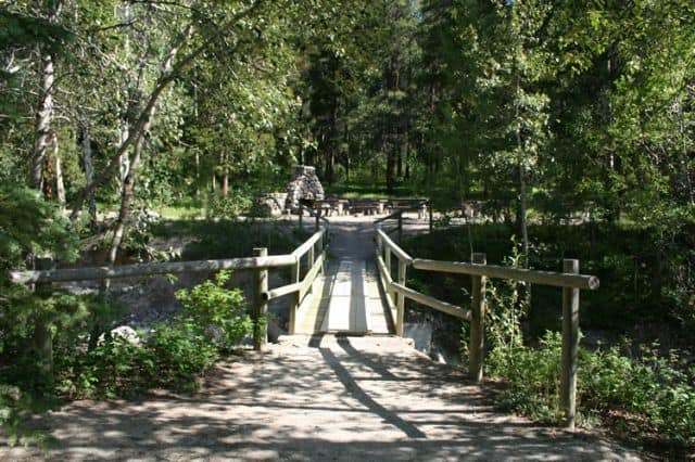
The trailhead to the hike is located at the Fireside Recreation Area in Banff National Park. There is a big stone fire pit and picnic tables at the trailhead. The first kilometre of the adventure is easy going, level hiking along a single track trail. At the first trail junction on the trail take a left and begin the steep climb up. This is the first section of switchbacks of many. The trail continues to climb to the top of the first ridge. Great views of trail and valley below.
The Cory Pass trail continues along rock cliffs and up and around massive boulders working its way around a canyon leading to a rock slide. Cross the rock slide to an open valley and then switchback your way up to the top of Cory Pass. Fantastic views of Alberta, Canada mountain ranges, hoodoos, snow capped peaks and the valley below.
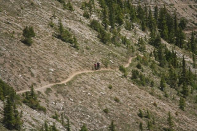
The Cory Pass Trail connects with the Edith Pass trail near the hoodoos on the summit. Behind the hoodoos is a valley of rock slides and Mount Edith. Follow the rock cairns along the massive rock slide for about 1.5 kilometres. On the other side of Mount Edith is an opening into the trees - that is the Edith Pass Trail.
The trailhead of the Edith Pass Trail that is located in the trees is identified by a yellow sign. The Edith Pass Trail is a heavily forested trail, with exposed tree roots and slippery sections. On the lower sections of the trail it widens out, is mostly forested, less treacherous and more manageable. The Edith Pass Trail eventually connects back up with the Cory Pass Trail.
Always prepare wisely when hiking in Banff National Park. In this case, the Cory and Edith Pass Trails are high altitude hiking... weather, clothing, liquids, eye wear and foot wear become important factors.
Always dress in layers and wear good hiking boots. At the highest elevations there are often, big winds and colder temperatures as you are exposed to the elements. Most months there is still snow on these trails at the higher elevations.
The lower mountain sections of these Banff National Park trails have park signs with directional arrows and route distances leading to other hiking destinations in the Banff National Park. Some of the connecting trails include the Forty Mile Creek Trail, Mount Norquay and Mount Louis Lookout.
Address:
