
Join Us
Join Us


Pigeon River Provincial Park is a wilderness hiking and waterfall sightseeing destination located on the shores of Lake Superior, on the banks of the Pigeon River and next door to the Canada/U.S.A. border.
The provincial park is a day use only park located southwest of the community of Thunder Bay, Ontario, Canada. Thunder Bay is part of the North of Superior region of Northern Ontario, Canada.
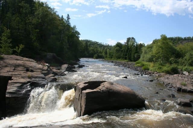
The Pigeon River Provincial Park measures about 949 hectares (2345 acres). The large park and river valley are well known for its deep gorges, rock walls, waterfalls, white water river rapids and canyon cliffs.
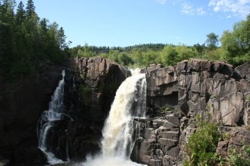
The park's geography and geology are very popular for hiking and sightseeing. The main attraction for many are the lookouts peering out over two waterfalls in the park - High Falls and Middle Falls.
There are numerous hiking and walking trails in the park ranging from easy-going to challenging.
Trails vary as per your fitness level and size of group. Some trails in the park are prone to moisture from the river and falls and therefore can be slippery and be a haven for mosquitoes.
Use rails when possible and tread carefully. Packing some bug spray would be another good idea just in case.
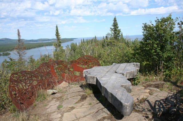
Many of the trails have sightseeing and resting benches. Some of the benches are unique as they are more like art sculptures.
Here is a list of the trails in the Pigeon River Provincial Park:
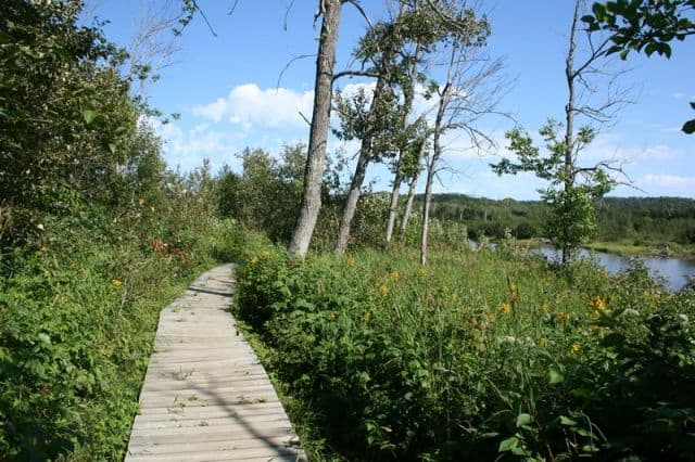
Boardwalk Trail : An easy-going one-way 350 metre (383 yd.) boardwalk trail leading to a lookout platform providing views of Lake Superior. The trail accesses a sandy beach which can hook up with the Finger Point Trail. Trailhead is near the information centre.
Finger Point Trail : A somewhat challenging one-way 2.5 kilometre (1.6 mi.) trek exploring a forest along the shores of Lake Superior eventually connecting to an elevated flat rock lookout platform and an artistic sightseeing bench on Finger Point. Fantastic views! Trailhead is near the information centre.
High Falls Trail : A somewhat challenging 2.0 kilometre (1.3 mi.) loop trail leading to a lookout overseeing the 28 metre (92 ft) High Falls. A section of the loop trail follows the Pigeon River exposing great views of the river gorge and canyon walls. Trailhead is near the information centre.
Middle Falls Trail : An easy going 700 metre (766 yd.) one-way trail leading to a lookout overseeing the 6 metre (21 ft) Middle Falls. The trail begins from the upper parking lot located on Highway #593.
Lookout Trail : A challenging one-way 1.6 kilometre (1.0 mi.) trail leading to a lookout overseeing Lake Superior and Pigeon River. The trail begins from the upper parking lot located on Highway #593.
Old logging Road Trail : An unmaintained challenging one-way 2.5 kilometre (1.6 mi.) trail leading to a lookout. The trail begins from the upper parking lot located on Highway #593.
Near the information centre (main office) is a day use picnic area, a playground for children and some washrooms.
Address:
