
Join Us
Join Us


Glacier National Park is one of the more rugged, remote alpine mountain parks in the Kootenay region located in British Columbia, Canada. The monster of a park is situated in between the communities of Golden and Revelstoke, BC. It covers 1340 square kilometres and is part of the Selkirk Mountain Range in the Columbia Mountains.
The Glacier National Park can be enjoyed, by both, from the seat of your car and when on foot. From your vehicle, the Trans Canada Highway dissects the park providing amazing scenic mountain views and wildlife viewing opportunities. On the highway are various viewpoints, picnic sites and rest stops. Make the time to stop and enjoy the scenery.
Rogers Pass National Historic Site is the best known rest stop in the park which also doubles as an information station and viewpoint. The National Historic Site located in the Glacier National Park is 80 kilometres east of the community of Golden and 73 kilometres west of the community of Revelstoke, BC.
Fees apply to access the backcountry areas in the park. Hiking and backpacking the Glacier National Park is mostly enjoyed by people with very good fitness levels as the trails are rugged and involve plenty of elevation gain. There are plenty of alpine mountain peaks, long narrow valleys and glaciers in the park. Over 420 glaciers in fact.
In the summer months (mid-July to mid-September) the park is a recreation destination popular for hiking, backpacking, caving, wildlife viewing and camping. There are basic camping sites in the park plus some wilderness huts (must be booked for a fee) that can be accessed via the trail network. Each campsites have tent pads and food poles (protect food from wildlife).
Some of the more popualr trails in the park include the Beaver Valley, Hermit, Cougar Valley, Avalanche Crest, Copperstain, Casualty Creek, Bostock Creek, Abbott Ridge, Asulkan, Sir Donald, Glacier Circle and the Persley Rock Trails.
The Nakimu Caves are located between the upper and lower Cougar Valley. They are a world famous caving destination in the Glacier National Park. The caves are best accessed by a 3-4 hour hike. The caves include many self guided routes providing an opportunity to view caving attractions like soda straws and moon milk.
In the winter months, heavy snowfall covers the park attracting ice climbers, winter camping, cross country skiing and snowshoeing. The conditions are harsh in winter because of the high elevations and low temperatures. Only experienced adventurers explore the park during these colder months.
Some of the alpine mountains in the Glacier National Park include Mt. McGill (2667 metres), Cougar Mountain (2393 metres), Abbott Mtn. (2454 metres), Mt. jupiter (2789 metres), Mt. MaCoun (3033 metres), Mount Sir Donald (3237 metres), Mt. MacDonald (2878 metres), Grizzly Mtn. (2758 metres) and hermit Mtn. (3079 metres).
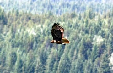
The protection of the Glacier National Park also protects many different types of wildlife and plants. It is recorded that the park is home to over 54 different type of mammals, 183 birds and 684 families of plants.
Address:
