
Join Us
Join Us


Kokanee Glacier Provincial Park was established in 1922 and is one of the oldest wilderness parks in the British Columbia park system. The 32,035 hectare park is located in the Selkirk Mountains, between Slocan and Kootenay Lakes, near the community of Nelson and Kaslo, BC in the Kootenay region of
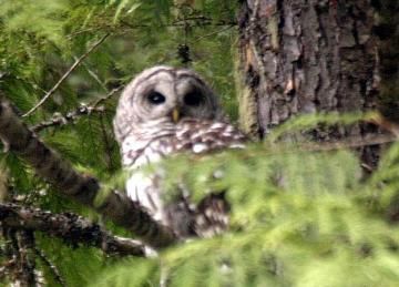
 The Kokanee Glacier Provincial Park is well known for its mountain peaks, 30+ alpine lakes, varied wildlife, challenging hiking trails, mountain peaks and three glaciers - Caribou, Kokanee and Woodbury.
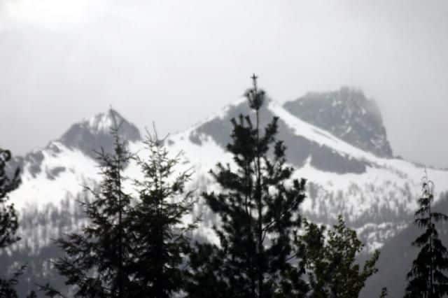
Mountains in the Kokanee Glacier Park include Sunset, Outlook, Olsen, Kokanee, Grays, Pontiac, Boomerang, Granite Knob, Moonlight, McQuarrie, Sunrise and Chipman. Some of the hiking trails in the park lead through mountain passes located at the base of some of these giants. For example the Gibson Lake Trail which navigates between the Kokanee and Outlook Mountains leads backpackers through the Kokanee Pass.
Lakes in the Kokanee Glacier Provincial Park include the Kokanee, Crazy Jane, Sapphire, Gibson, kaslo, Helen Deane, Keen, Heather, Garland, Tanal, Boot, Joker, Rosehip, Oltedi, Naimet, Lendrum and Natenek Lakes. Some lakes are accessed via the trail network, others are remote wilderness lakes with no trail access. Gibson, Tanal and Kaslo Lakes permit fishing for cutthroat and rainbow trout. The only lake permitting air access via float plane is Crazy Jane Lake.
Rivers and creeks in the Kokanee Glacier Provincial Park provide the means for the spring snow melt to escape the park. During the winters the streams and lakes are often frozen over. During the late spring the rivers and creeks come alive.
Recreation wise the Kokanee Glacier Provincial Park is an activity destination for the heartiest of explorers looking for a hiking and backpacking challenge exploring through meadows, deep valleys and thick forests connecting to alpine peaks, remote creeks and glacier lakes.
Some of the mountain trails in the park are day hikes while most are rough, challenging overnight backpacking adventures. All explorers should be well prepared for fast changing weather conditions. There are no services in the park. You are on your own so prepare wisely.
It is important to be well versed in wilderness backpacking and hiking when exploring in the Kokanee Glacier Park. All backpackers should be experienced and equipped with good hiking boots, rain gear, warm clothing, sleeping bag, waterproof matches, flashlight, compass, flares, a waterproof tent and reliable cooking gear.
There are over 100+ kilometres of wilderness trails in the Kokanee Glacier Park. The trails explore alpine peaks, glaciers, meadows of flowers, run-off creeks and mountain lakes. Backpacking is best from July to October after the snow melt.
The long haul trails in the park provide designated areas for camping. The type of camping depends on the trail route. There are three cabins ( Silver Spray, Woodberry and Slocan Chief), a picnic shelter and some wilderness campsites scattered throughout the park for overnight backpackers.
Some of the trails in the Kokanee Glacier Park include the Gibson Lake, Nilsik Creek, Lemon Creek, Enterprise Creek, Blue Grouse Basin, Woodbury and Scranton Mine. There are many trails near the park, but are not in the park like the Old Growth, Fishermaiden Lake, Billy Valentine and Fletcher Lake Trail.
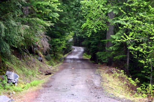
Travel to the community of Nelson, BC. Once in Nelson continue traveling 19 kilometres northeast on Highway #3a towards Kokanee Creek Park and Kokanee Glacier Road (Gibson Lake Rd). Continue on the gravel, sometimes rough, Kokanee Glacier Road for 16 kilometres to Gibson Lake and a parking lot. If arriving from the east travel west to the Kootenay Lake Ferry which connects Crawford Bay to Balfour. From Balfour travel Hwy #3a west for 15 kilometres to the Kokanee Creek Park gates.
An alternate route is located in Willow Point just west of the Kokanee Glacier Road entrance on Hwy #3a. It is a rougher route following along the gravel Duhamel Creek FSR (Forest Service Road) to the Lemon Creek FSR which then leads to a parking area and the Nilsik Creek Trail.
Near Ainsworth Hot Springs on Highway 31 is another entrance to the park is via the Woodbury Creek FSR. From the highway it is 13 kilometres to the parking area and trailhead to the Scantin Mine and Woodbury Trails.
Further north is another road accessing the park near Kaslo, BC. The Keen Creek FSR is located 6 km northwest of Kaslo. Travel the gravel Keen Creek Road for 16.5 kilometres to the trailhead at Desmond Creek.
Address:
