

Join Us
Join Us


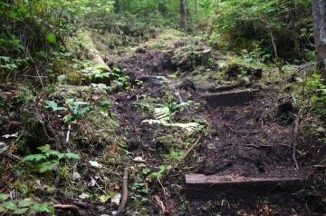
An experienced hikers adventure with lots of challenges and rewards. The trail is very vertical with plenty of opportunity for stair climbing, rope climbing and depending on the seasons, trekking though mud and navigating around wash-outs. The trail system is located west of Queen Charlotte City on Graham Island, B.C.
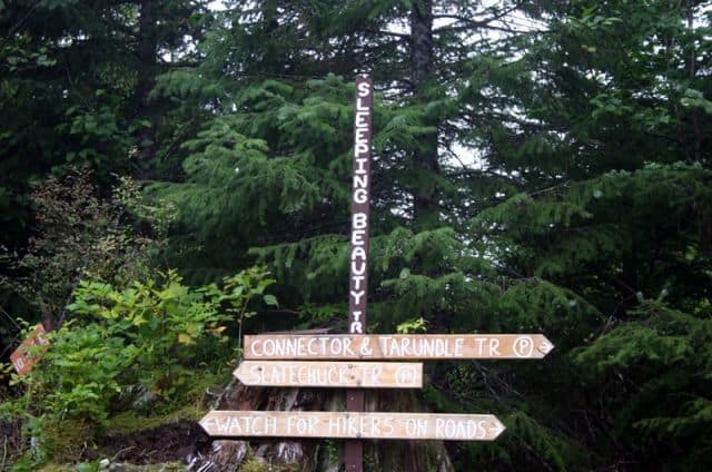
 The Sleeping Beauty Trail is the best known rainforest trail in an area of many trails. At the foot of the trail is a map outlining all the connector trails within the region. Many of which, are wilderness trails with little maintenance and clearing. Exploring deeper into the forests beyond the Sleeping Beauty Trail should be attempted by experience hikers with proper equipment and navigation skills.
The main vertical trail crosses bridges, tumbles over tree roots, climbs wooden stump-like steps, ladders, ropes and slogs through mud much of the way. But what is a little mud... nothing, when the summit views at the end of your hike take your breathe away. The trail can be wet as it is a rainforest. Fog is known to hang around, especially in the morning and there is an avalanche warning posted because of heavy run off.
The trail to the summit takes 1.5 - 2 hours for most to climb up to the top of Mt. Genevieve (729 metres). Coming down it takes 45 minutes. The steep decline is dangerous and can be very slippery. It is hard on the knees for some and wipe-outs are a possibility. There are points when descending backwards down the steep trail is a safer option. There are plenty of discarded tree stumps on the route to sit and rest on during the hike.
The rest of the trails that make up the Sleeping Beauty Trail System includes the wilderness treks of Tarundi Trail to the 1018 foot summit of Mount Raymond; the Connector Trail to a picnic site exploring the area around Nipple Mtn; and the toughest one is the Slatechuk Mountain Trail leading to the 1009 summit of Slatechuck Peak.
Address:
