

Join Us
Join Us


Cup and Saucer Trail is one of the most popular hiking trails located on Manitoulin Island, Ontario, Canada. The popular trail is located southwest of the community of Little Current and southeast of Kagawong in central Manitoulin.
The island of Manitoulin, itself, is located in Rainbow Country in Northeastern Ontario on Lake Huron of the Ontario Great Lakes.
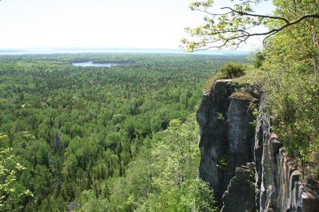
The main Cup and Saucer Trail leads hikers and sightseers to some jaw-dropping views from on top of limestone cliffs which form part of the Niagara Escarpment. The escarpment extends through parts of Ontario, Canada, New York, USA and Michigan, USA - covering a total of 725 kilometres.
The escarpment was carved out by the retreating glaciers during the Ice Age. What was left behind were layers of hard dolostone rocks (magnesium limestone rock) which are less susceptible to erosion.
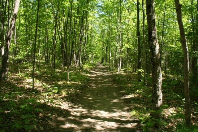
The Cup and Saucer includes over 12 kilometres of hiking trails in total. The main single-track, easy-going trail is well signed earthy path leading to a viewpoint.
Hiking to the lookout is mostly done under tree cover providing plenty of shade. However, there are sections of the main trail with exposed tree roots and small boulders - so when wet - they can become slippery.
From the parking area the trail begins with a level 2 km section before reaching a fork in the trail. On your left is a 1.5 km side trail (which reconnects back with the main trail). Many decide to stay on the main trail for another 1.3 km before connecting to another fork and a trail map.
From the main junction (fork) one can hike 0.3 km to the "East Lookout" (not to be missed). Just prior to the lookout, on your right, is the entrance to a 3.5 km adventure trail. The adventure trail is a loop route which connects back with the main trail and circles back to the main junction. The highest point on the trail is 325 metres (1,154 ft).
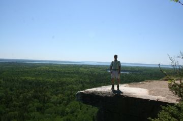
The best views on the Cup and Saucer are from the "East Lookout". From the cliffs of the lookout there are far reaching views spanning hundreds of hectares overlooking forest, lakes and blue sky horizons.
To access the lookout requires two climbing sections to get to the top of the cliffs. This is the hardest part of the trail. Be aware that the "East Lookout" is exposed and not fenced. So be safe and avoid getting to close to the edge.
While hiking the Cup & Saucer Trails it is important not to stray off the paths so to minimize any contact with poison ivy. No one likes hiking with itch and rash.
Address:
