.jpg)

Join Us
Join Us

.jpg "misery_bay_nature_reserve_manitoulin_island_ontario_73 (3)")
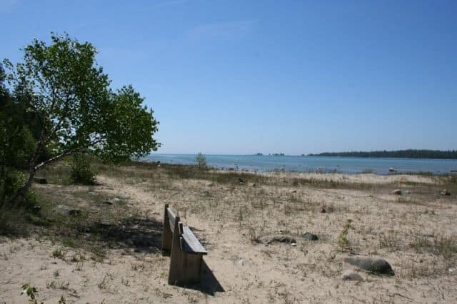
Misery Bay Provincial Nature Reserve is an park destination located on the shores of Lake Huron on the west side, southern shores of Manitoulin Island in between the villages of Evansville and Meldrum Bay. Manitoulin Island, itself, is part of Rainbow Country in Northeastern Ontario.
The 860 hectare (2125 acre) nature park is one of the more popular sightseeing and hiking destinations on the island. The nature reserve was was created to protect the natural eco systems in the region including the wildlife, rare plants, wetland habitat and, something called, alvar.
What is alvar? "Alvar" is flat limestone bedrock with little, usually no, trees which are exposed to moody, often rough, weather. Alvar are only located in the Baltic Sea (Europe) and the Great Lakes of Ontario (Canada).
Misery Bay Provincial Nature Reserve provides opportunities to view rare plants, birds and wildlife. Wildlife in the area includes birds like sandpipers, bald eagles and American bitterns. There are also recorded sightings of red fox, leopard frog and turtle.
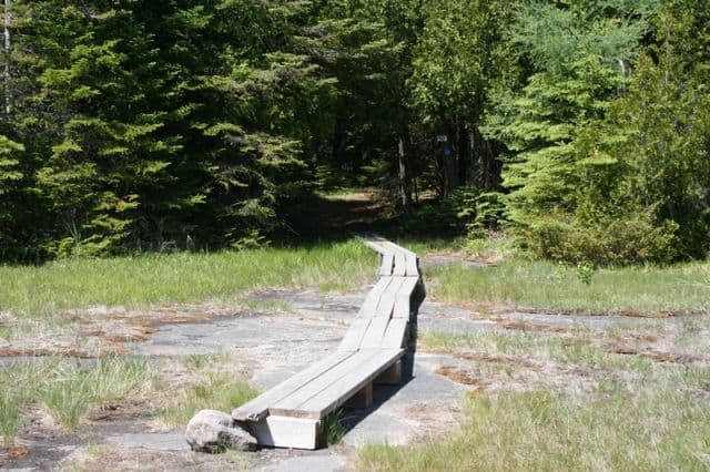
There are numerous hiking trails in the Misery Bay Provincial Nature Reserve including Little Misery Point Trail (1 km); Southern Horizon Trail (1 km); Boardwalk Trail (0.6 km); Lakeshore Trail (3.2 km); Wolf Den Trail (1.9 km); Forest Trail (2.5 km) and Mac's Bay Trail (4.8 km).
Sightseeing highlights enjoyed in the Misery Bay Provincial Nature Reserve include Mac's Bay (a private cove at the end of the Mac's Bay Trail) and the many kilometres of rocky and sandy shoreline on Lake Huron. (Lakeside Trail).
The hiking and walking trails are easy going and relatively flat - suitable for all ages. The trails are well signed and marked for easy navigation.
There is an information centre onsite which provides summer educational programs, as well as, tours, trail maps, washrooms and a day use picnic site. Located along the paths, at major trail junctions, are posted trail maps.
Most of the trails follow a sand, flat rock and/or dirt path. Some trails hike in the shade while others are exposed to the hot sun. Bring your hat, sunscreen and sunglasses.
Address:
