


Join Us
Join Us


Shelford Opal Trail is a network of hiking trails in the Eagle Creek area located off Highway 35 on the way to Francois Lake located west of Burns Lake, British Columbia, Canada . The trail network is best known for the precious minerals in the area which include opals and agate rocks. Today, the main trail leads to an active rock hounding destination so people can look and hunt for precious minerals.
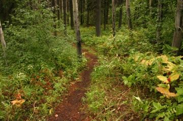
The 1.9 kilometre Opal Bed Trail is the main hiking path in the region leading to the opals and agates. The hiking trail begins by hiking to a short ridge. From the ridge the trail leads pass a flat field to views overlooking a creek. Opals are recorded as being found in between the creek and the trail. Also the natural wonders referred to as Hoodoos (rock formations) are seen above the creek at this point of the hike.
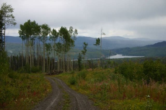
The 1.8 kilometre Lookout Loop Trail provides many viewpoints of the valley before it loops back down to the recreation site. There are some short steep sections on the trail before reaching the viewpoints overlooking the Eagle Creek Valley, the community of Burns Lake and Tchesinkut Lake.
The 0.8 kilometre Beaver Pond Trail follows a creek down to a couple of beaver ponds. The level easy grade trail is a popular route also used by geese and moose - so bring a camera.
The campground is base camp - with the Opal Bed, Beaver Pond and Lookout Trails all starting from the recreation site. The wilderness recreation site acts as Mile "0" for these three trails. There is an information billboard at the entrance of the campground. The recreation site is located at the end of the gravel road approximately 7 kilometres from the highway turnoff.
There are many twists and turns on the gravel road and be advised to keep your head up for directional signs. The drive to the trailheads also explores clear cut valleys of the area. A natural pest - Pine Beetle - killed the trees in the region leaving little choice but to log the area leaving barren landscapes.
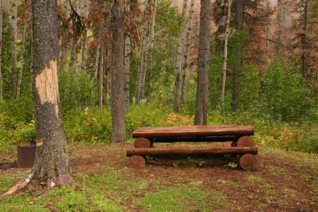
Each campground enjoys a wooden picnic table and a fire pit. Most sites are grass, treed and private. Be aware some sites are in rough shape. There is no drinking water nor is there any firewood at this campground... make sure you pack some in.
The final trail in the network is the Eagle Creek Trail. This is the first trailhead you will encounter on your way to the campground. The hiking trail is more like a connector trail or an alternative walking route to the campground. The Eagle Creek Trail is 1.4 kilometres. The trailhead (look for stone fountain) is located 3.5 kilometres from the turn off on Hwy 35. The trail comes out of the trees 1 kilometre before the recreation campground.
It was in the early 1980's that a local resident, john Shelford, discovered opals and other precious minerals in the Eagle Creek area and made a claim. But in the mid 80's John Shelford proposed to withdraw his claim on a condition that the region be protected and identified as a "Staking Reserve" and made available to the public for rock hounding.
Address:
