An easy day trip from Vancouver takes you back into time! Take Part in Living History at Kilby Historic Site Exploring British Columbia's Kilby Historic Site is like stepping into a scene from our past making it possible...
Making Snow Cream in Canada Making Winter Treats with Fresh Snow How do you make snow ice cream? It's super easy! I will share how we make our ice cream from fresh fallen snow below. With only 3 simple ingredients, there...
Unlocking Opportunities: Navigating Tourism and Economic Development Grants "You get one chance to securing grant monies for your project. Select the right grant writer has everything to do with your success." Touri...

 Flank Trail


Print
flank20
Whistler

Trail Length: 45 km

Difficulty: Difficult
Park Amenities:
Mountain Biking
Sightseeing


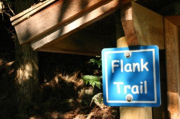
Some say the Flank Trail in Whistler, British Columbia, Canada is one of the most beautiful scenic mountain bike rides in the Whistler Valley. The 45 km biking route is filled with ups and downs traveling along a hard-packed earthy single-track trail with wicked downhill sections, some switchbacks and some climbs offering up some spectacular views of the Whistler and Blackcomb Mountains.

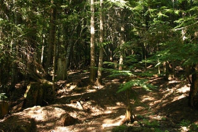
The trail is considered challenging because of the distance and the difficulty of some of the sections of the mountain biking trail. Most of the mountain bike trail is single track riding with some sections of technical riding crossing over exposed tree roots and loose rocks.

The one-way route follows the slopes of Sprout Mountain from Alexander Falls in the Callaghan Valley to 16 Mile Creek Trailhead on Cougar Mountain Road. There are other access points to the trail throughout the valley. One of the most used access routes are the two trailheads mentioned above and the Rainbow Trail.

The trail highlights the valley between Rainbow and Sproat Mountains and should take 5 to 6 hours to complete on a mountain bike. The highest point of the trail is near 16 Mile Creek reaching an elevation of 1500 metres. From the creek trailhead the route leads to Alpine Meadows via following 19 Mile Creek. Continue along the trail to 21 Mile Creek before reaching Function Junction and Alexander Falls.

Explore the Flank Trail in Whistler, British Columbia, Canada

Address:

Flank Trail
Cougar Mountain FSR
Whistler
Canada

How To Get ToFlank Trail

:
The northern trailhead is located 6 Km north of Whistler Village, BC, Canada on the Cougar Mountain FSR near 16 Mile Creek. The trailhead is marked with signage. The southern entrance to the mountain biking trail is near Alexander Falls near Callaghan Valley about 15 km south of Whistler Village.
No reviews yet for Flank Trail.

Recently Visited BC Parks

Stoney Hill Regional Park East of Duncan British Columbia Canada
Duncan BC

Stoney Hill Regional Park is in the Municipality o...

Sir George Simpson Historic Landmark - East Kootenay B.C.
East Kootenay Historical Landmark Sir George Simpson

The Sir George Simpson historical landmark is loca...

Bear Creek Falls - Glacier National Park Canada
Revelstoke, B.C

Bear Creek Falls in Glacier National Park of Canad...


Hiking With Your Children - Canadian Rockies Family Hiking Guide
Explore British Columbia
Wells Gray Golf & RV Resort - British Columbia, Canada
Find what Birds to Look For in this Park

Come Experience the Nicola Valley!