


Join Us
Join Us


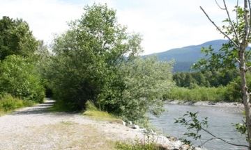
The main trail extends along the shores of the Mamquam River eventually leading to the fish spawning channels. From the main trail are many off-shoot trails exploring further into the river shoreline. The trails are either hard-packed earthy trails or loose gravel trails, sometimes both. The trails vary in width, some are single track and some are allot wider.
The trail is located on a dyke road found just after the bridge crossing over the Mamquam River located north of Squamish on the Sea to Sky Highway (Hwy 99). Turn onto the gravel dyke road and park. Look for the most well used trail heading towards the river identified by a large opening in the thick vegetation. This is the trailhead to the Mamquam River (it is not marked).
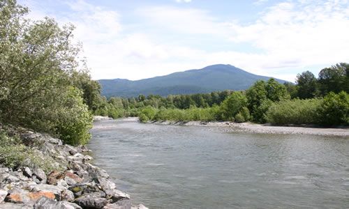
Once arriving on the rivers edge there is an interpretive sign outlining the spawning cycle of the salmon. Continue walking or biking east of the Hwy 99 bridge following the shoreline of the Mamquam River and the spawning channels will come into view. The Coho and Chum Salmon visit this river between the months of August and November.
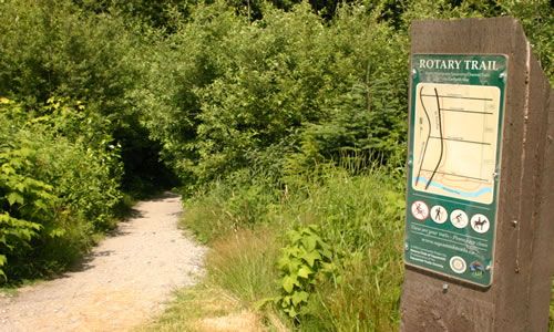
The Mamquam River Trail area is filled with little off-shoot trails used mostly by mountain bikers and horseback riders. One of the trails is called the Rotary Trail. This trail slices through tall shrubbery creating tunnel like pathways. The Rotary Trail connects to Mamquam and Diamond Road and to Garibaldi Way and the Garibaldi Highlands Trails.
Considered a prime river to practice canoe and river kayaking skills on and enjoy 2- 4 runs in one single day. An opportunity to try new things as you get familiar with the river. The Grade 3 paddling route extends 6 Km (3.4 miles) from the Mamquam Forest Service Road (upper put-in) to the Government Road Bridge (lower put-in) located west of the Sea to Sky Hwy.
Address:
