Sechelt
British Columbia
Canada
Trail Length: 22 kmDifficulty: ModeratePark Amenities:
Angus Creek Loop Trail is located nearest the community of Sechelt, BC on the lower section of the Sunshine Coast. The challenging Angus Creek Loop Trail covers over 22 km (13.2 mi.) and should take an experienced rider 1.5 - 2.5 hours to complete when starting from the Sechelt-Crucil Forest Service Road.
The rewards of this mountain biking route includes some fantastic views of Sechelt Inlet, Mt. Richardson, the Caren Range Plateau and of the town of Sechelt, on the Sunshine Coast, BC, Canada.
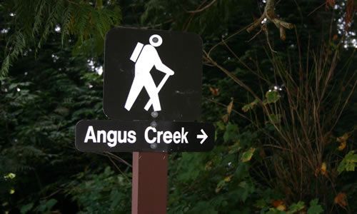
The Angus Creek Bike Loop Trail is identified by the mountain bike signs and the orange paint rings. The biking route starts off with a steep climb for 4 km (2.4 mi.) following Irgens Creek along the Sechelt-Crucil Forest Service Road past a landfill and then continuing to the major junction on the road. Take a left turn and continue biking on the leveling trail for 7.5 km (4.5 mi.) crossing over Burnett and Angus Creek. On the descent down to the Gray Creek crossing follow the main line back to the highway.
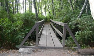
The biking trail is more of a hiking trail with some interpretive signs when starting from the beach area trailhead of the Angus Creek Trail located in Porpoise Bay Park. The walking trail is well maintained with bridges and some interpretive signs discussing salmon spawning. The trail does intersect the bike loop trail and becomes less maintained following a deactivated logging road leading to magnificent views.
Angus Creek, Sechelt, BC, Canada : Parks & Trails
Address:
Angus Creek Loop Trail
Sechelt-Crucil Service Road
Sechelt
Canada
How To Get ToAngus Creek Loop Trail
:
How to Get Here: Follow Hwy 101 to Sechelt, BC and at the traffic light on Wharf Street take a right. A couple blocks further take another right on to Porpoise Bay Road which becomes Sechelt Inlet Road. Continue for 4 km (2.5 mi.) to Porpoise Bay Park. Park your vehicle here at Porpoise Bay Park and unload. Now bike 3 km (1.8 mi.) back the way you came until the Sechelt-Crucil Service Road.
No reviews yet for Angus Creek Loop Trail.