


Join Us
Join Us


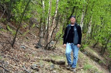
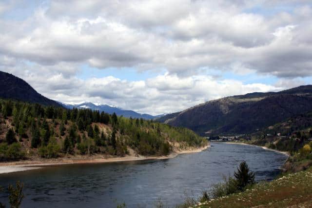
Columbia River Trail is a hiking and sightseeing trail exploring along the eastern banks of the Columbia River near the community of Trail, BC in the West Kootenay region of British Columbia, Canada. The 7 kilometre one-way trail explores a high ridge with rock bluffs.

The Columbia River Trail begins from a signed, trailhead, found at the end of a rough gravel access road located north of the community of Trail, BC near the Sunningdale water tower.
The narrow hiking trail follows an dirt and sandy path. The trail is easy going most of the way with some sections covered with exposed tree roots and loose rocks. Along the route hikers climb over rock slides, bypass big boulders and explore through white spruce forests. Watch for ticks as this is tick country.
The narrow trail continues along a dirt path to a northern trailhead located near Jordan Creek. Near Jordan Creek the Columbia River Trail connects to Columbia Road.
At this point of the trail hikers have an option of returning back the same way they came or continue along the gravel road to Ootischenia which is south of the community of Castlegar, BC. The entire route, combining the hiking trail and the gravel road is 25 kilometres long one-way.
The hiking trail is an "Environmental Sensitive Trail" therefore no motorized vehicles are permitted on the trail.
Travel to the community of Trail, BC. In Trail follow the main highway over the bridge away from downtown. Take a left on 2nd Ave. Follow 2nd Avenue to Gyro Park. Continue past the park, now traveling on Charles Lake Drive. The road forks. Take Hazelwood Drive on your left. It is a circle route connecting to Marianna Crescent. At the high end of the loop route is a yellow gate and road leading to a sandpit. Take the road all the way to the trailhead. Look for tree markers.
Address:
