
Join Us
Join Us


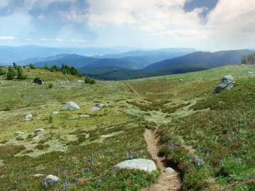
Brent Mountain Trail is a moderate uphill hike leading to some scenic viewpoints. The 4.8 km one -way trail leads explorers to the summit of Brent Mountain and 360 degree views of the Okanagan Valley and the Coast and Monashee Mountain Ranges.
 The rough trail has exposed rocks and tree trunks. It is important to wear proper hiking boots and pack in water. The hike reaches the peak of Brent Mountain which stands at approximately 2203 meters (7228 feet).
The Brent Mountain Trail explores pristine alpine areas and should take around 4-5 hours to hike there and back along the same trail. The hiking trail provides good opportunity to view wildlife. Birdwatchers in particular will enjoy this hike.
The trail explores the forest before it reaches the alpine summit. At the summit is an old Forest Fire lookout tower.
Address:
