
Join Us
Join Us


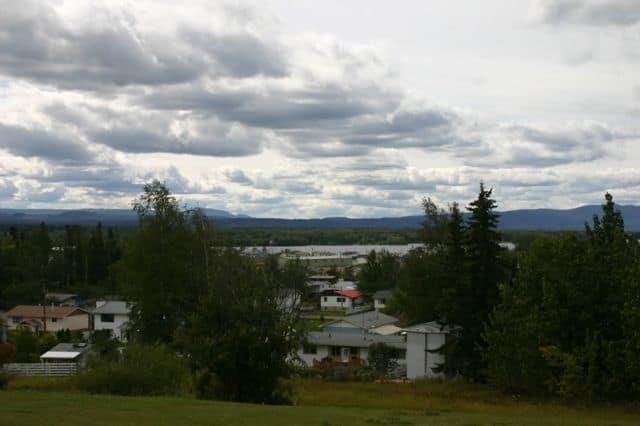
Dickenson Trail in Fort St. James, British Columbia, Canada is up the hill behind the village of Fort St. James. The moderate grade hiking route leads uphill to a viewpoint on a bluff with spanning views of the valley below.
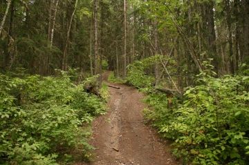
The route follows an earthy path through a mixed forest of trees, rich with low lying vegetation hiding deadfall trees and the moss covered forest floor. When hiking the trail there are grooves sliced into the trail created by seasonal run-off water carving a path down the mountain. In some seasons this route can get muddy.
The trailhead is only a short drive east of the village up behind the local school on a hill. In the subdivision on the hill is a paved street that ends and then begins again as a gravel road. Hike a short 400 to 500 metres on the gravel road to the trailhead marker located on the right leading up the mountain.
From the trailhead to the views is about 2 kilometres. The hike is short but steep with some sections of the path more difficult than others. The trail should take no longer than 2-3 hours to complete a round trip adventure. Make note that on our trip we found the trailhead poorly marked and the sign missing.
Address:
