
Join Us
Join Us


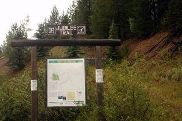
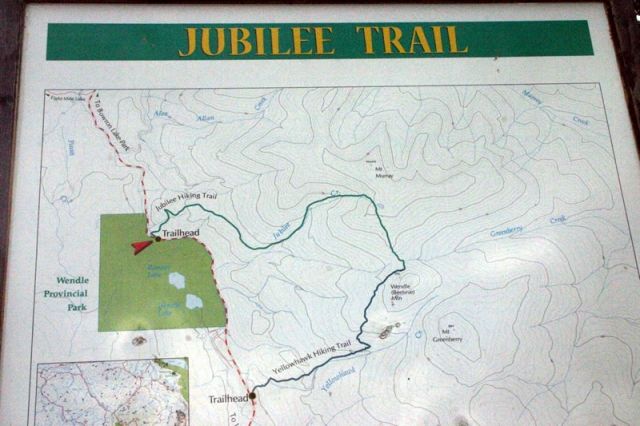
Jubilee Trail in North Cariboo-Chilcotin Region, British Columbia, Canada is a moderately easy 9.5 kilometre route trekking along an old forestry logging road to the alpine peak of Mount Murray. The round trip alpine trail is located south of Bowron Lake, northwest of the community of Wells and north of the heritage mining town of Barkerville.
The alpine route climbs 668 metres to the peak of Mount Murray. And from the peak the option exists to go back down the same way or to continue along Murray Ridge to some cabin remains and to another trail. The entire loop route takes anywhere from 3 - 5 hours to complete depending on your groups fitness, the route taken and the weather conditions.
The trail is mostly enjoyed by hikers and cross country skiers. Many enjoy the route for the views. From the mountain peaks are a series of wide ranging viewpoints looking out over the surrounding mountain ranges, alpine valleys, Bowron Lake Park and the communities of Wells and Barkerville.
The main trail starts off following an old logging road for 2.5 kilometres to the base of a series of switchbacks. Continue up the switchbacks through the alpine forest to the treeline. Continue to the peak of Mount Murray from the treeline.
Once at the peak some return back the same route, while others plan for the extended loop route exploring south along Murray Ridge to the Yellowhawk Trail. Both trails are relatively well marked going up to Mount Murray. Although finding the trail marker sometimes can be hard when connecting the two trails together. Be prepared.
Both trails start from the same gravel road. If your group hikes to Mount Murray on the Jubilee Trail and then plan on hiking down the Yellowhawk Trail there is a 3 km stretch of the Bowron Lake gravel road that connects the two trailheads at the bottom. The gravel road forms a loop route which can be walked or biked. Or make sure to set up two vehicles (one at each trailhead) for a shuttle service.
Be prepared when hiking the peaks of this trail as wind can pick up and temperatures can drop, even in the summers. It is important to layer your clothing and have plenty of water and good hiking boots. The trail system is in wildlife country. Be bear aware.
Address:
