
Seeker Bio

How to Hike the Bruce Trail in Ontario Canada

When to Hike the Bruce Trail: Day Hikes, Section Hikes & Thru-Hikes
Exploring Ontario's Most Famous Hiking Trail
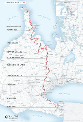
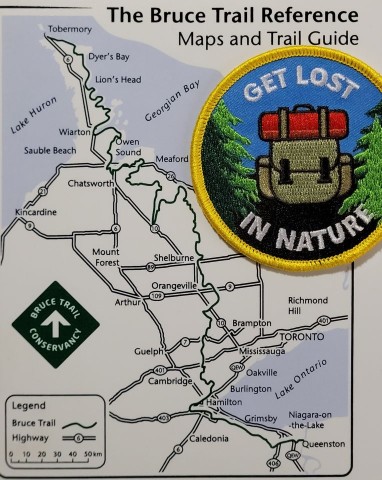
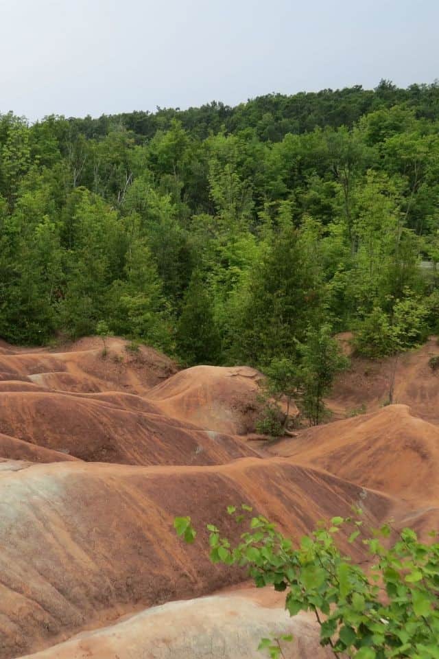
Spanning more than 890 km (553 mi) along the Niagara Escarpment, the Bruce Trail is Ontario's oldest and longest marked hiking trail - and one of Canada's most accessible long-distance hiking adventures. The route runs from Queenston Heights near Niagara Falls to Tobermory on the Bruce Peninsula, passing through hardwood forests, conservation areas, stunning National Parks, gently rolling farmland, scenic waterfalls, and expansive views over Lake Ontario from atop dramatic escarpment cliffs.
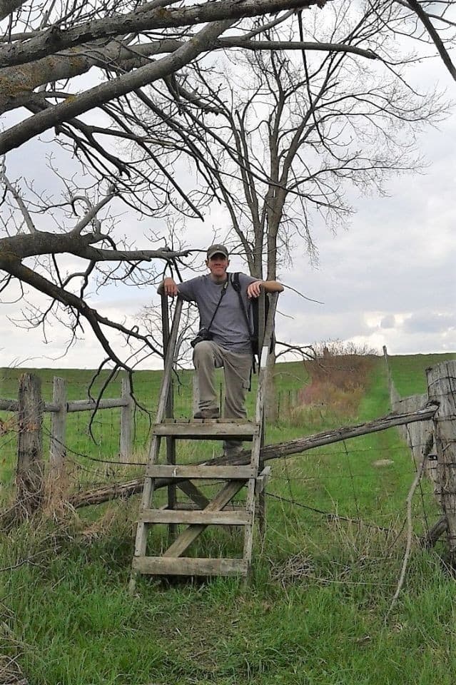
Designed primarily for section hiking, the trail allows travelers to experience short day hikes, weekend trips, or long-distance adventures. Many hikers return year after year to complete additional sections while exploring nearby towns and parks. Over nearly a decade, we have spent more than 40 days hiking the full length of the trail, gradually discovering its landscapes, wildlife, viewpoints, and communities. This guide shares practical planning tips, section highlights, and day-hike ideas to help travelers experience the Bruce Trail at their own pace.
Key Facts About the Bruce Trail
- Location: Niagara Escarpment, Ontario, Canada
- Length: 890+ km from Queenston Heights to Tobermory
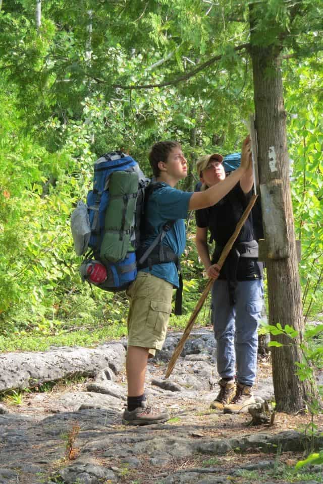
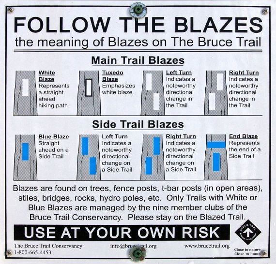
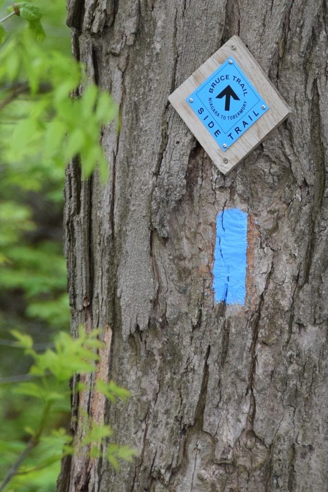
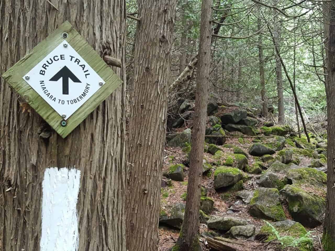
- Marked Trails: Main trail marked with white blazes. Additional 400+ km (248.5 mi) of side trails marked in blue
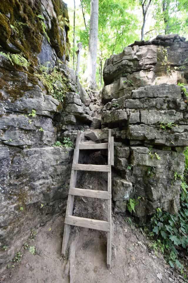
- Trail Type: Mixed surfaces including narrow earth footpaths, gravel rail trails, farm tracks, quiet country roads, paved surfaces
- Managed By: Bruce Trail Conservancy. Nine regional clubs: Niagara, Iroquoia, Toronto, Caledon Hills, Dufferin Hi-Land, Blue Mountains, Beaver Valley, Sydenham, and Peninsula
- Best time to go: Late spring through fall. Some sections accessible in winter
- Cost range: Mostly free. Parking fees may apply and some conservation areas may charge entry fees
- Time needed: Sections can be explored in independent day hikes, end-to-end treks take 1-3 weekends, and thru-hikes take weeks
- Accessibility: Urban and rail-trail sections are family-friendly. Remote areas are rugged and more challenging

What Is the Bruce Trail?
In addition to the main white-blazed trail, more than 400 km (248.5 mi) of side trails extend the network, providing alternate routes and access to viewpoints, waterfalls, and conservation areas. These side trails often lead to scenic highlights and make it easy for travelers to plan shorter hikes.
Why Visit the Bruce Trail?
Travelers visit the Bruce Trail in Ontario for its combination of natural beauty, local history, outdoor challenge, and access to some of southern Ontario's most scenic landscapes.
Highlights include:
- Breathtaking views from atop dramatic cliffs overlooking Lake Ontario, Georgian Bay and rolling countryside
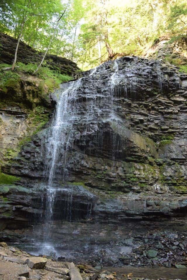
- Scenic waterfall hikes near Hamilton Ontario and the Niagara Region
- Historic towns and rural landscapes along the escarpment corridor
- Flexible hiking options ranging from short walks and day-hikes to multi-day trips
- Excellent wildlife viewing and birdwatching opportunities in forests, wetlands, and conservation areas
Many of southern Ontario's most popular waterfall and escarpment day hikes are located along the Bruce Trail, making it one of the most accessible ways to experience the region's natural landscapes close to urban centers.
How Do You Experience the Bruce Trail?
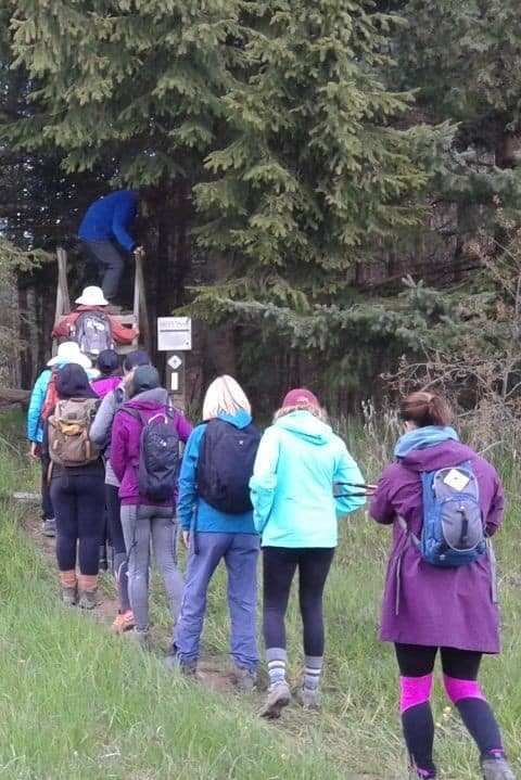
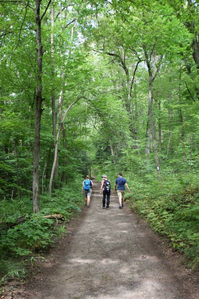
Most hikers explore the Bruce Trail through section hiking, completing smaller segments over time. This approach allows travelers to plan hikes around seasonal highlights, weather, transportation options, and accommodations while enjoying the most scenic parts of the trail.
Section Hiking
Section hiking is the most common way to experience the Bruce Trail. Hikers choose individual trail segments for day hikes or weekend trips, often combining them with nearby parks or communities. Benefits of section hiking include the flexibility to fit shorter hikes into busy schedules, to carry lighter packs and to spend more time exploring nearby towns and attractions. One challenge of section hiking is the lack of public transportation along the trail. As such, hiking with a friend and bringing two vehicles can be the best strategy in order to avoid having to walk out and then double back along the same route to your parked car.
Thru-Hiking
Thru-hiking the entire trail in one continuous journey is possible but requires careful planning. Wild camping along the trail is prohibited or highly discouraged in most areas, and designated campsites are infrequent. In addition, distances between resupply points are often considerable, and in many cases supply points are located well off-trail. Furthermore, outside of major population centers like Hamilton and Toronto public transportation to and from trailheads is not available, making logistics more complicated. Finally, a thru-hike of the entire trail takes most hikers around 30 days, making careful planning necessary.

Planning Tips for Hiking the Bruce Trail
Before heading out on Ontario's Bruce Trail a bit of preparation can help ensure a safe and enjoyable experience, whether you're embarking on a short day-hike or attempting a longer trek.
- Use maps and trail resources from the Bruce Trail Conservancy to plan your route
- Download navigation tools like one of our Top Hiking Apps for Trails in Canada, or the Bruce Trail App
- Select footwear designed for hiking or trail-running on variable and challenging terrain, and dress for changing weather conditions
- Bring enough snacks and water to last for the duration of your walk
- In summer, pack insect repellent for forested sections and sunscreen and a hat for more exposed areas
For travelers interested in long-distance hiking, our Hiking Gear Guide Part 2: Beyond the Basics for Long-Distance Treks in Canada.
Bruce Trail Sections and Popular Day Hikes
The Bruce Trail is divided into nine regional sections, each offering different landscapes, communities, and hiking experiences. Many visitors explore the trail through day hikes within these sections.
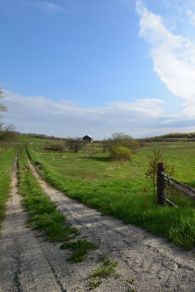
1. Niagara Section – Queenston to Grimsby (80 km /50 mi)
This southernmost section starts at the stone cairn in Queenston Heights Park, passing through St. Catharines and Thorold and crossing all four Welland Canals before reaching Short Hills Provincial Park. Known for its vineyards, scenic views, and historic towns.
Day Hike Recommendation: Hike from Queenston Heights to Brock's Monument for a scenic 5–6 km walk overlooking the Niagara River.
2. Iroquoia Section – Grimsby to Milton (121.7 km / 75.6 mi)
Beginning at Beamer Memorial Conservation Area, this section features waterfalls like Albion, Tiffany, Webster's, and Tew's Falls. The trail passes Dundas Valley, Waterdown, and Crawford Lake Conservation Area, with its rare meromictic lake and reconstructed Iroquoian village.
Day Hike Recommendation: Tiffany Falls Loop near Hamilton offers a short 3–4 km hike featuring a beautiful waterfall and boardwalk trails.
3. Toronto Section – Kelso to Creditview Road (50.7 km / 31.5 mi)
This urban-adjacent section includes Hilton Falls and Limehouse Conservation Areas, Scotsdale Farm property, and the Silver Creek Valley. It is hilly, featuring a total elevation gain of 2,296 ft, scenic views, and access to natural spaces close to the city.
Day Hike Recommendation: Hilton Falls Conservation Area offers a 6–8 km loop featuring a waterfall and scenic woodland trails.
4. Caledon Hills Section – Creditview Road to Mono Centre (63.5 km /39.5 mi)
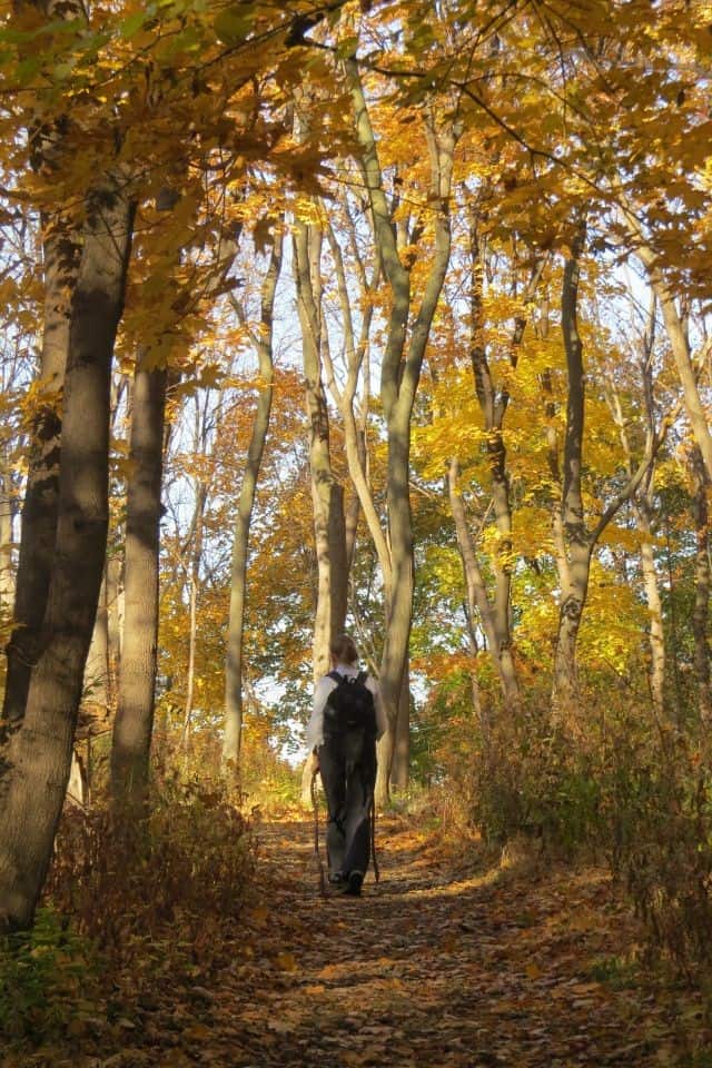
This section follows glacial moraine deposits along the Escarpment ridge. It features mature hardwood forests, wetlands, and excellent birding opportunities. It is especially popular for viewing fall colors.
Day Hike Recommendation: Terra Cotta Conservation Area offers an easy 5 km loop through forest and meadow trails.
5. Dufferin Hi-Land Section – Mono Centre to Lavender (50.5 km / 31.4 mi)
This section follows pioneer-era routes such as Hurontario Street, linking Lake Ontario to Georgian Bay. It offers expansive views over Lake Ontario and enchanting walks through mixed hardwood forests.
Day Hike Recommendation: Mono Cliffs Provincial Park offers 4–6 km hikes with dramatic cliff-top viewpoints.
6. Blue Mountains Section – Lavender to Craigleith (67.0 km / 41.6 mi)
This section of trail traverses ski resorts, climbs high bluffs, and descends into deep valleys. Highlights include expansive views over rolling countryside and Georgian Bay.
Day Hike Recommendation: Hike to Overhanging Point for spectacular escarpment views.
7. Beaver Valley Section – Craigleith to Blantyre (114 km / 70.8 mi)
The Beaver Valley section crosses the Loree Forest plateau, ascends high cliffs like Kimberley Rock and Old Baldy, and passes by Hoggs Falls.
Day Hike Recommendation: Hoggs Falls Loop offers an easy 3 km walk with waterfall views.
8. Sydenham Section – Blantyre to Wiarton (168 km / 104.4 mi)
This section winds along the Bighead River and threads through the Bayview Escarpment Nature Reserve. Highlights include Inglis Falls, scenic caves, wooden boardwalks, and opportunities to observe rare ferns.
Day Hike Recommendation: Inglis Falls trails provide short hikes through forests and along waterfalls.
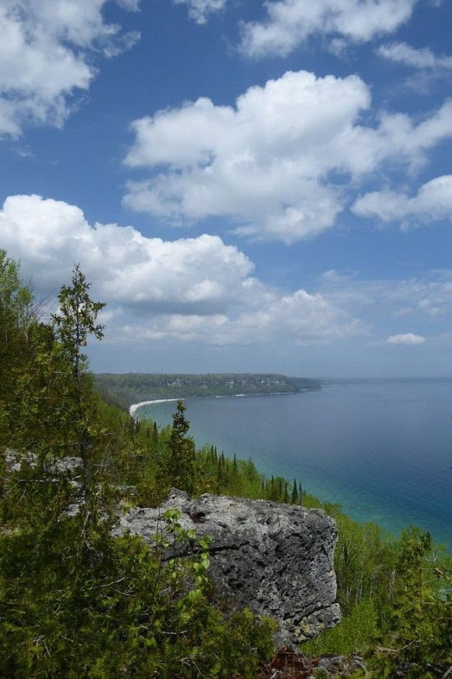
9. Peninsula Section – Wiarton to Tobermory (162 km / 100.7 mi)
The northernmost section of the Bruce Trail offers challenging, remote hiking with stunning flora, fauna, and geology. Highlights include high cliffs overlooking Georgian Bay and the northern terminus in Tobermory.
Day Hike Recommendation: Trails in Bruce Peninsula National Park provide 5–10 km hikes along escarpment cliffs and shoreline viewpoints.
FAQs About the Bruce Trail
Can you hike the Bruce Trail End-to-End?
Yes. Some hikers complete the entire Bruce Trail in one continuous journey, but most people explore it gradually through section hikes. Limited camping and transportation between trailheads make thru-hiking more complex, so many hikers spread the experience over several seasons or years.
Is the Bruce Trail family-friendly?
Some sections are well suited to families and beginner hikers, particularly conservation-area trails and shorter escarpment paths. Remote sections may include steep climbs, rocky terrain, and longer distances, making them better suited to experienced hikers.
Can I hike the Bruce Trail with my dog? Most sections of the Bruce Trail are pet-friendly, as long as dogs are kept on a leash and waste is removed. However, dogs are not permitted in some sections of the main trail and side trails at the request of property owners. These areas are specified on the Bruce Trail website as well as by signage on the trail itself.
How long does it take to hike the entire Bruce Trail?
The time required depends on how the trail is approached. For example, many thru-hikers complete the route in around 30 days, with the fastest known times being just over 8 days. However, most hikers explore the Bruce Trail through day hikes and weekend trips.
What should I bring when hiking the Bruce Trail?
Bring water, snacks, sturdy footwear, weather-appropriate clothing, insect repellent, and a trail map or navigation app. For longer hikes, consider emergency supplies, extra layers, and transportation planning since some trailheads are far from towns and public transit is unavailable.
When is the best time to hike the Bruce Trail?
Spring through fall is the most popular hiking season, offering waterfalls, wildflowers, and vibrant autumn colours along the escarpment. Winter hiking is possible in some areas but in remote areas can require traction devices and experience with snowy or icy trail conditions.
Personal Highlights from the Bruce Trail
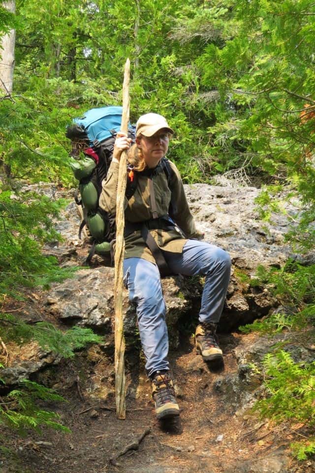
Over nearly a decade of exploring the Bruce Trail, we have hiked the entire length from south to north, taking around 40 days to complete it. We undertook the journey in a series of independent day hikes, organized weekend end-to-end events of some sections, and one epic 12 day thru-hike of the Peninsula and Sydenham sections. Our most memorable moments and highlights included:
- Learning about Black History along the Fort-to-Fort Trail in the Niagara Section
- Enjoying the fall colours while walking the Iroquoia Section around Hamilton, Ontario
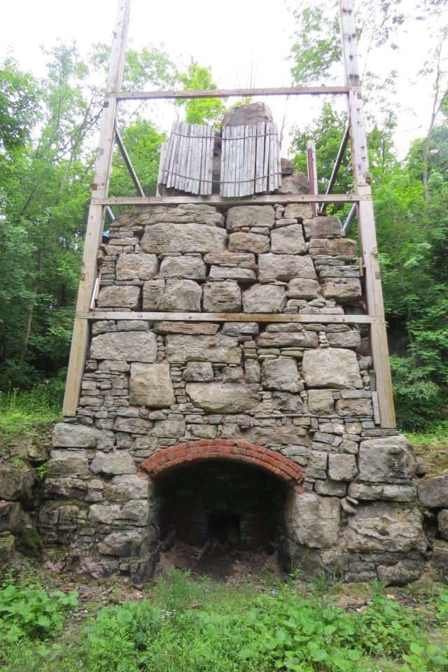
- Exploring the historic kilns at the Limehouse Conservation Area while hiking the Toronto Section
- Visiting the many waterfalls, especially Tiffany Falls near Waterdown Village
- Meeting other hikers and trail volunteers during an end-to-end hike of the Caledon Hills Section
- Visiting the Scenic Caves near the Blue Mountain Ski Resort in Collingwood while hiking the Blue Mountain Section
- Spending a night under the stars at the High Dump campsite in Bruce National Park while thru-hiking the Peninsula Section
These experiences show how the Bruce Trail can be both a short local escape and a long-term adventure for travelers exploring Ontario's landscapes. Ultimately, our journey along the Bruce Trail sparked a life-long love of hiking that led us to do a 4-year #Hike4Birds walk from Cape Spear, NL to Victoria, BC on the Trans Canada Trail.

Summary / Takeaway
The Bruce Trail can be enjoyed in short day hikes, longer organized end-to-end section hikes, or a complete thru-hike. As such, it offers one of the most rewarding ways to explore the landscapes of the Niagara Escarpment. The Bruce Trail combines scenic landscapes, local history, and natural challenges. With proper planning, preparation, and a sense of adventure, travelers can enjoy a fully immersive Canadian hiking experience, one step at a time, along one of the country's most iconic trails.
When you subscribe to the blog, we will send you an e-mail when there are new updates on the site so you wouldn't miss them.


Comments 5
This is on my plan for this year. Thanks for writing this.
This was an amazing hike. The Hole-in-the-wall and the underwater passage was incredable to dive into. Little freaky and really cold.
Amazing write up! The Niagara section of this was right behind my house growing up. I loved wandering and exploring. Always heard about how far it went! Great way to lay it out visually. Thank you for sharing this. I definitely still explore that trail when I visit Ontario. And it may be closer than I think sometimes too! I will keep this handy!
Brava Braun You're welcome! Are you planning to hike the entire trail, or focus on certain sections? If you have any questions I'd be happy to help. It is a beautiful hike!
Did you explore the grotto at Bruce National? That was a frighteningly tight squeeze and quite crowded when we walked through. The water was so cold it made us numb, but after all the hiking we weren't complaining