


Join Us
Join Us


The Galatea Trail is a difficult and challenging hiking trail in the Spray Valley Provincial Park in Kananaskis Country of Alberta, Canada. The trail leads to some remote alpine lakes located at the base of Galatea Mountain which stands at 3185 metres.
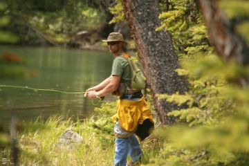
 The lakes - Lillian and Galatea Lake - are the two highlight destinations located at the end of the trail. It is a popular adventure route for hiking, backpacking, wilderness camping and shore fishing for brook and cutthroat trout.
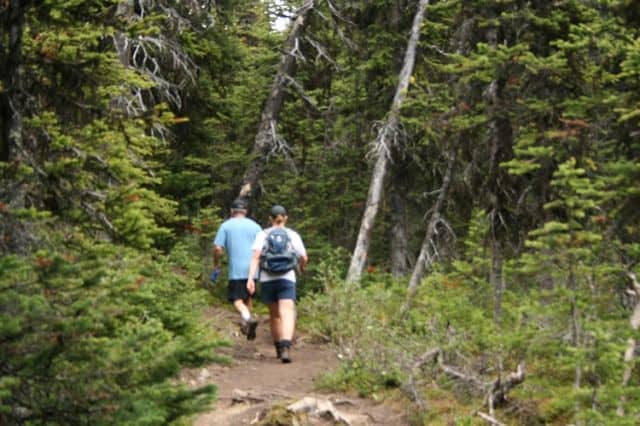
The Galatea Hiking Trail is a challenging, one-way 6.5 kilometre hiking adventure with an elevation gain of 460 metres. It involves plenty of uphill hiking, some determination and good foot work criss crossing over foot bridges, log bridges and high stepping exposed rocks and tree trunks.
The Galatea Trail crisscrosses Galatea Creek 9 times before connecting with Lillian Lake. It should take anywhere from 6 -8 hours return to complete the hike to Lillian Lake depending on the size and fitness levels of group and the weight of your day pack or backpack.
The hiking trail up is mostly a single track trail following a narrow dirt and earthy path. Much of the trail is hiking under a forest canopy while following a series of switchbacks up the mountain.
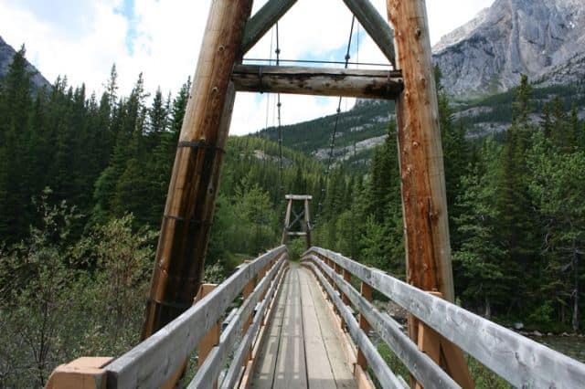
The trail begins from the Galatea parking lot. From the trailhead the route drops down to the banks of the Kananaskis River before meeting up with a long suspension bridge. Cross the bridge and the trail begins on the other side.
After you cross the suspension bridge there is a junction - a trail intersection between the Galatea Trail and the Terrace Trail. Keep left at the junction and begin climbing up the mid mountain slope. Most of the next 4 kilometres of the Galatea Trail, from here on in, is uphill navigating steep switchbacks.
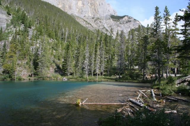
Around the 4 kilometre point you cross the 9th foot bridge over Galatea Creek and a steep section is ahead. But it is a short lived challenge as the trail levels out at the junction of the Galatea Trail and the Guinns Pass Trail. After the junction, a kilometre or so further, is your first destination - Lillian Lake.
At Lillian Lake there is a shoreline trail exploring around the lake. There are access points to the lake for fishing. Where you first arrived at the lake is a wilderness campsite with a picnic area, tent pads, fire pit, food caches, pit toilets and some firewood.
For the die hard hikers there is an extension to the trail which leads up to Galatea Lake. Galatea Lake is a more remote and rugged lake destination. It is another 1.6 kilometres and 160 metres in elevation gain to get from Lillian Lake to Galatea Lake.
Address:
