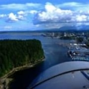
Sunshine Coast Parks and Places
Egmont, BC Parks, Trails & Places
Gibsons Parks, Trails & Places
Halfmoon Bay, BC Parks, Trails & Places
Lund, BC Parks, Trails & Places
Pender Harbour Parks, Trails & Places
Powell River Parks, Trails & Places
Roberts Creek, BC Parks, Trails & Places
Saltery Bay Parks, Trails & Places
Sechelt Parks, Trails & Places
Texada Island Parks, Trails & Places
Iris Griffith Wetlands

The short boardwalk path extends above the wetlands and the wildlife. The boardwalk trail has some viewing benches and interpretive signs along the short path.
Read moreMadeira Park Rd
Madeira Park
Knucklehead Mountain
During the summer seasons the trails are used by naturalists and backpackers primarily and when the winter arrives the trails transform into single track cross country ski and snowshoeing trails.
Read moreLund
Shelter Bay Regional Park

Shelter Bay Regional Park is located on Texada Island, BC. Hikers, mountain bikers, campers, bird watchers, kayakers and photographers should make an effort to explore this beautiful park.
Read moreVan Anda
Mount Daniel Hiking Trail

Mount Daniel Hiking Trail is an uphill climb covering 3-4 km (1.8 - 2.5 mi.) each way. The hike up the steep grade should take (1-2 hr ) to reach the peak. Coming back takes less time as you trek down the mountain.
Read moreGarden Bay Road
Pender Harbour
Davis Bay Beach

The identifying feature of Davis Bay is the long pebbled beach coastline with a well developed paved walking path lined with viewing benches while highlighted with a long wooden fishing pier jutting out from the shoreline.
Read moreHighway 101
Sechelt
Clack Creek Mountain Bike Loop Trail

Clack Creek Mountain Bike Loop Trail is a challenging mountain bike adventure that covers 12.3 km (7.4 mi.) cutting through forests exploring any of the many off-shoot trails.
Read moreGruman Road
Roberts Creek
Chatterbox Falls

Sechelt
Influencer:
Triangle Lake Hiking Trail

The hiking-only trail follows, mostly, along Colvin Creek through second growth Alder and Douglas Fir trees leading up to the views looking over Triangle Lake.
Read moreRedrooffs Road
Halfmoon Bay
Copeland Islands Provincial Marine Park

Kayakers usually plan a visit after launching from Lund on their way to the marine wonders of Desolation Sound. Scuba diving draws people to the area to explore the underwater reefs and marine activity as Copeland has many protected bays and sheltered inlets to explore.
Read moreLund
Blackwater Creek Trail

Blackwater Creek Trail in Powell River, BC Canada on the Sunshine Coast is a comfortable 4 km hike and mountain bike ride. The trail route is used by both hikers and mountain bikers, so keep your head up.
Read moreBurma Road
Powell River
Simson Provincial Marine Park

Simson Provincial Park is 461 hectare marine park in the Thormanby Islands. Accessed by water only, the preferred mode of transportation to the islands is a small boat, kayak or dingy
Read moreHalfmoon Bay
Roberts Creek Pier Regional park

The park is situated around a natural rock pier protruding out from the shoreline. There is a pathway leading out to the point for a grand view of the coastline
Read moreRoberts Creek
Hidden Grove Trail

The Sunshine Coast trail leads through old growth forests, a marsh wetland and leads to the headwaters of Davis Creek. The Hidden Grove Trail section is just a small part of the bigger picture. The region is actually divided into four park sections.
Read moreSechelt Inlet Road
Sechelt
Tuwanek Point Beach Trail

This Sunshine Coast Park, Tuwanek Point Beach Trail is a short trail covering over 2 km ( 1.2 mi.). The trial route leads to Irvine Creek and then to views of the ocean coastline.
Read moreSechelt Inlet Road
Sechelt
Tetrahedron Provincial Park

The network of trails, the numbers of lakes and creeks while hiking, snowshoeing and cross country skiing in the Tetrahedron Provincial Park provides days of enjoyment and many photo moments.
Read moreGray Creek Forest Service Road
Sechelt


