Wolf Creek Trail

Difficulty: Easy - Family
Park Amenities:
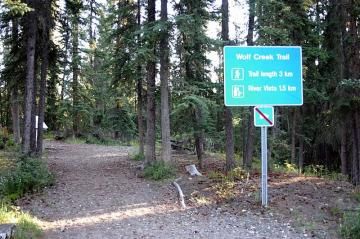
Wolf Creek Trail
Wolf Creek is a recreation destination located in the community of Whitehorse, Yukon Territory, Canada. The trail explores along the banks of the Yukon River and Wolf Creek. The entire route is 2.8 kilometres long and should take no longer than 2 hours to walk at a leisurely pace.
 The trail includes a series of numbered trail markers which correspond with a walking trail map available in the community of Whitehorse or from a drop box posted at the trailhead (drop box was empty on our trip). At the trailhead is a covered shelter and picnic tables.
The trails in the area are popular for hiking, sightseeing, cross country skiing and mountain biking. There are picnic tables, a shelter, playground, many interpretive signs and 2 viewing platforms looking over the Yukon River.
Wolf Creek Trail explores clock wise through a Boreal Forest. A forest which was shaped by a forest fire. Spruce and Lodgepole pine trees make up most of the forest. Lodgepole pine trees are more dominate in the area as it is one of the first trees to grow back from a fire as their seeds are tolerant to flame.
Near the Yukon River there are views of Grey Mountain. As you walk away from the Yukon River and back into the woods take a quick look over the bank and you will see some telegraph lines from 1899 hanging in the trees.
Where the trail meets Wolf Creek there is a beaver dam downstream. And if you time your trip right and arrive in late August you may be able to watch Chinook Salmon spawn . The salmon travel thousands of kilometres from the Bering Sea to the Yukon River so to spawn in Wolf Creek.
Near the Alaska Highway, the Wolf Creek Trail connects to the Escarpment Trail (a.k.a. River Vista Trail). The River Vista Trail consists of a short elevation hike leading to a lookout viewpoint which provides views of the Yukon River and the surrounding valley and mountains.
On the north end of the Wolf Creek Trail after the viewing platforms is another loop hiking trail which leads hikers further north along the banks of the Yukon River. The extension trail adds another 3,5 kilometres to your adventure. It is less maintained and there are no interpretive signs. The extension trail loops back to the Wolf Creek Trail.
Address:
How To Get ToWolf Creek Trail
: