Auriol Hiking Trail

Trail Length: 15 kilometre
Difficulty: Moderate
Park Amenities:
Kluane National Park & Reserve, Yukon Territory, Canada
Auriol Trail
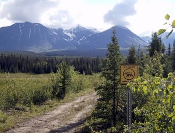
The Auriol Trail is a recreation trail located in the Kluane National Park and Reserve near the community of Haines Junction, Yukon Territories, Canada. The adventure trail explores the valleys and forests of the sub alpine and lower slopes of the Auriol Ridge of the Auriol Mountain Range.
 The First Nation people of the region - the Southern Tutchone - refer to the mountains in their native tongue as Nashat'ay. The name refers to the special way the sun reflects off of the mountain ridges.
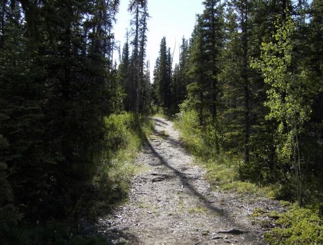
The 15 kilometre ( 9 mi ) adventure trail was originally an old wagon trail used by cross country skiers until the land became part of the Kluane National Park and Reserve. Now the trail is a recreation trail popular for hiking, backpacking, wilderness camping and xc skiing.
The Auriol Trail is a loop trail. It crosses over creeks. It explores through aspen and spruce tree forests. There are footbridges and switchbacks with plenty of elevation hiking. The route includes an elevation gain of about 400 metres (1300 feet) and should take backcountry hikers about 5-6 hours to complete. The elevation reached during this adventure exceeds 1160 metres (3800 feet).
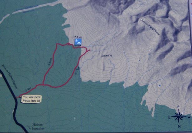
The Auriol Trail begins be exploring open grass fields before entering into an aspen and spruce forest. The first 2 kilometres of the trail follows the old cross country ski route to a junction. The junction is the beginning and the end of the loop trail.
Stay left and the next 5.3 kilometres leads to the Auriol Ridge and a wilderness campsite. The right side is a tougher route, with bigger elevation gains, but includes more viewpoints. The path on the right is the better route for coming back down.
Stay left and at the 3.5 kilometre mark of the trail it opens up into a meadow like wetland area. Here, the trail may be flooded so be prepared for soggy conditions. The plus side is that when you are in marsh like country in the Yukon you are also in moose country. So be alert for wildlife sightings.
After the marsh the trail re-enters the forest. Continue along the trail and soon later you come across a river valley. After the valley you enter the sub alpine area of the hike. The wilderness campsite is just ahead.
The wilderness campsite is located half way ( 7.3 Kilometres) on the trail. It includes 4 tent pads, a food cache and pit toilets. From the wilderness campsite it is 5.7 kilometres back to the junction ( beginning of the loop portion of trail ). Along this section of the adventure are some viewpoints overlooking Haines Junction and the Ruby Ridge Mountain Range.
From the campground there is an extension trail leading higher up into the alpine. It is an unmaintained trail and requires good hiking and navigation skills. This trail is a common access route for mountain climbers wanting access to Quill Peak, Mt. Martha Black and the many other unnamed peaks in the Auriol Range.
The Auriol Trail adventure is in the heart of "Bear Country". When enjoying the trail make noise and camp smart. Know your wildlife etiquette and always give wildlife the right of way. And for your own comfort, when exploring in the Yukon wilderness, always carry mosquito repellant.
Auriol Trail near Haines Junction, Yukon Territories, Canada in the Kluane National Park & Reserve
Address: