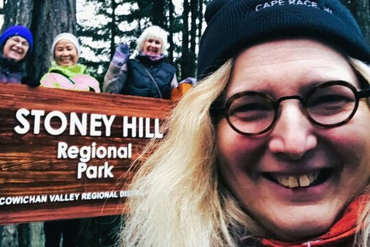
Stoney Hill Regional Park East of Duncan British Columbia Canada


Trail Length: 3.2 km (2.0 mi)
Difficulty: Easy - Family
Park Amenities:
Stoney Hill Regional Park
North Cowichan Regional Park near Duncan BC Canada
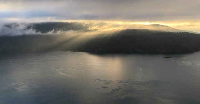
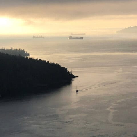
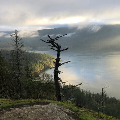
Great views of Vancouver Island, Salt Spring Island, Sansum Narrows and the Southern Gulf Islands
Stoney Hill Regional Park History
Stoney Hill Regional Park is a North Cowichan Regional Park near Duncan BC Canada.The First Nations name for Sansum Narrows is sqtheq which means narrows. Jared Qwustenuxum Williams has shared his Nation’s traditional legend of a sea monster, called Sheshuq’um that lived near the narrows which are known to transform into dangerous churning rapids at change of tide. The monster was a head with a huge mouth full of teeth, and it had a long unfurling tongue that would pull those travelling too close in canoe under the water where people would drown or be eaten, leaving only the splintered remains of canoes to be washed ashore.
The Battle of Sheshuq’um
This presented a great problem for the people trying to navigate between Hwtl’upnets (Maple Bay) and Tl’ulpalus (Cowichan Bay), two historical First Nations villages and communities today. While many tried, no one was able to defeat Sheshuq’um. Then the chief heard of a strong man known as Smakw’uts who lived in what is known as Port Roberts in Washington State, but called Smakw’uts after this legendary hero. In desperation the chief asked for Smakw’uts’ assistance. Using a cape the strong man slung stones towards the monster, the first stone landed in Ladysmith the second landed near Mayne Island, a third landed in Hwtl’upnets.
Strong man known as Smakw’uts
The hero, realizing that Mt. Maxwell on Saltspring Island was in the way, of his stone throwing, asked for the mountain to hunch down so he could hit Sheshuq’um and the mountain obliged, receiving the name Hwmet’utsum, which means bent-down place. With the last stone, the monster was defeated and was eventually turned to stone. Jared explains that this story is important to his people and describes their connection to the land. It explains the area’s topography as all of these large stones can still be seen in the places described today. It also provides a warning of the currents boiling below the rock bluffs of Stoney Hill Regional Park.
The Southern Gulf Islands
Colonial history reports that Royal Navy officer Arthur Sansum was a first lieutenant aboard the HMS Thetis under Captain Augustus Kuper and served on the Pacific Station, between 1851 to 1853. The names Sansum as well as Kuper (Island) and Thetis (Island) also remain as landmarks in the region today, although Kuper Island has been restored to its First Nations name, Penelakut Island.
The land for Stoney Hill Regional Park was granted by a private owner in the 1980’s to the regional district for the creation of a park and today the surrounding area is a combination of park, forestry, and private lands.
Interestingly due to the significant cliffs and boulders this area has been a hangout for the University of Victoria Rock Scaling Club starting at the beginning of the 1970’s and today there are over 200 routes for both sport and trad climbers.
Why Go to Stoney Hill Regional Park?
For the spectacular views, one of the best on Southern Vancouver Island, an easy clearly marked trail with facilities. It only takes about 20 minutes of hiking to reach the rocky bluffs and the views. The park is an accessible hour drive from Victoria or Nanaimo and provides the perfect excursion on its own or as part of a day trip to check out the other communities in the area Chemainus, Duncan, Ladysmith.
Bring binoculars for wildlife viewing. Killer Wales, Sea Lions, Harbour Seals travel through the narrows. Deer and the occasional black bear can be found in the forest. Many birds frequent and make the park their home as well.
While the trail is also popular with trail runners and the surrounding cliffs with rock climbers, often you will find yourself being the only one on the trail. Dogs are welcome in the park but must be kept on a leash.
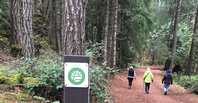
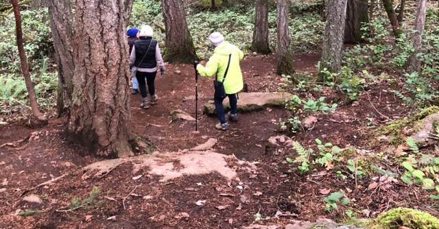
Trail Description
Stoney Hill Trail is clearly marked and loops through forest and rocky outcrops with some elevation climb. Hiking the loop counterclockwise will mean carefully going down a steep rocky section rather than going up it. This short section with loose shifting rocks is easy to navigate with care. The trail can become muddy in the winter and after rain. Please use caution around the rock cliffs and be respectful of the surrounding private property.
Trail Notes
Distance 3.2 KM/2.0 Mi
Elevation gain 108 m /354 ft.
Hiking time 45 min – 1 hr.
Facilities
Parking: The parking lot is at the trailhead and can accommodate up to 25 vehicles
Toilets
Signage information and maps
Nearby Attractions
Maple Mountain, Mount Tzouhalem, and Mount Prevost are North Cowichan’s other key hiking and mountain biking destinations for longer trails and hikes.
The Town of Ladysmith, explore this town’s living heritage with walking tours, Ladysmith Museum, Holland Creek hiking trails and the Old Town Bakery is not to be missed for the cinnamon buns.
The City of Duncan has a Totem Walking tour, a year-round farmer’s market, winery tours, the B.C Forest Discovery Centre, the Raptor centre and the Cowichan Bay Maritime Centre.
The Town of Chemainus has over 50 wall murals to explore, the famous Chemainus Theatre, trendy boutiques and galleries and golf at the Mount Brenton Golf Club. Take a ferry to Thetis & Penelakut Islands.
Address:
How To Get ToStoney Hill Regional Park East of Duncan British Columbia Canada
: