Kootenay Parks and Trails
Moonraker Trails - Mountain Biking
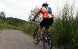
Moonraker trails and roads are popular for hiking, mountain biking and horseback riding in the summer months. During the winter months the network of trails become routes for snowshoeing and cross country skiing.
Read moreDogtooth Canyon Forest Service Road
Golden
Maiden Lake
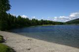
There are viewing benches constructed around Maiden Lake. Ideal front row seats for birdwatching, people watching and having lunch. At one end of the lake is a small sandy beach and a swimming pier.
Read moreFernie
Redstreak Trail - Kootenay National Park
Redstreak Trail is a 2.3 km hiking adventure exploring a river eco system before connecting with Redstreak Mountain. The trail is located in the Kootenay National Park of British Columbia, Canada near the Village of Radium Hot Springs.
Read moreHighway 93
Radium Hot Springs
Summit Lake Provincial Park
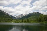
The 6 hectare recreation and campground park rests in a river valley in the Nakusp Range of the Selkirk Mountains between Upper Arrow Lake and Slocan Lake. Summit Peak at 2270 metres is one of the higher peaks one can view from the park.
Read moreNakusp
Grohman Narrows Provincial Park, Nelson
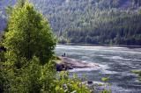
Grohman Narrows Provincial Park is a 10 hectare day use park located west of the community of Nelson, BC in the Kootenay region of British Columbia, Canada. The park protects the sensitive habitat of several plants and animals while providing visitors with exceptional views of the Kootenay River.
Read moreNelson
Millennium Walkway
The walkway is a 1.8 kilometre wide, paved recreation path enjoyed, mostly, by walkers, rollerbladers, dog walkers and bikers. Some use the path as a connector route for getting around the community while others use the walkway as a relaxing get-a-way destination for activity.
Read more5th Street
Castlegar
Jimsmith Lake Provincial Park, Cranbrook
Jimsmith Lake Provincial Park is a campground and day use park located near the south end of the community of Cranbrook, BC in the East Kootenay region of British Columbia, Canada. The park campground is set in a forest of Douglas fir and larch trees while the day use area consists of grass lawns
Read moreJim Smith Lake Rd
Cranbrook
Fernie Community Trails
The collection of trails are both gravel and paved. Some are both. In the summer months the trails are used for hiking, walking, biking and jogging. In the winter months, after the snow has fallen, the trails become cross country ski and snowshoe routes.
Read moreFernie
Kaslo River Hiking Trail
Kaslo River Trail is home to activities like walking, hiking, jogging, birdwatching, mountain biking in the summer and cross country skiing in the winter.
Read moreRailroad Avenue
Kaslo
St. Mary Lake
St. Mary Lake is popular for fishing, canoeing, swimming and birdwatching. The roads and mountains around St. Mary Lake are popular for hiking, cycling, mountain biking and hiking. The St Mary River enters and exits the lake. The exit river is a good put- in point for rafting.
Read moreKimberley
SS Moyie National Historic Site, Kaslo
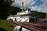
The SS Moyie is recognized as a National Historic Site and a BC Landmark. The well maintained and restored paddle wheeler is a historic museum. Inside are displays of pictures, artifacts and models depicting the history of the early 1900s living life on Kootenay Lake.
Read moreFront Street
Kaslo
Fairy Creek Falls Trail, Fernie
Fairy Creek Falls Trail is a hiking route exploring along a small creek leading to a viewpoint overlooking a 5 metre waterfall. The wilderness trail is located in the community of Fernie, BC in the East Kootenay region of British Columbia, Canada.
Read moreCommerce Road
Fernie
Doukhobor Discovery Centre Museum & Historic Site
Doukhobor Discovery Centre is a cultural museum, open to the public, located in the community of Castlegar, B.C., Canada. The museum is a reconstructed village depicting the lifestyle of the Doukhobor people in the early 1900s. The Doukhobors were some of the first settlers in the Kootenay Valley.
Read moreCastlegar
Wasa Lake Provincial Park
Hikers, bikers, dog walkers and roller bladders enjoy the 8 kilometre paved loop trail and side roads called the "Wasa Lions Way" path. For a slower pace, there is a short 2.7 kilometre interpretive path named the "Forest of the Rainshadow" which begins at the amphitheatre near the campground.
Read moreKimberley
Brilliant Overlook Trail
The trail highlights include the three viewpoints and some amazing scenery. The lower elevation viewpoint is situated at 772 metres. The higher elevation viewpoint is at 915 metres. While the third viewing area is located south of the cellular tower closer to the McPhee Creek Trailheads.
Read moreHighway #3a
Castlegar
