Buchanan Lookout Hiking Trail, Kaslo

Trail Length: 2 kilometre
Difficulty: Moderate
Park Amenities:
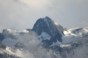
Buchanan Lookout Trail is a short hiking trail with magnificent mountain views located northwest of the community of Kaslo, BC in the Kootenay region of British Columbia, Canada. The Forestry Lookout Tower, the meadows of flowers, the hiking trail and the rock bluff viewpoints are some of the highlights of the Buchanan Lookout Trail.

The journey to the lookout is part of the adventure. To access the lookout visitors must navigate a 11 kilometre gravel forestry road and then hike a 2 kilometre trail. The road is rough, and at times uneven. Much of the gravel road travels uphill along mountain ridges, navigating hairpin turns and switchbacks. The road should not be attempted by low lying vehicles, campers or motorhomes.
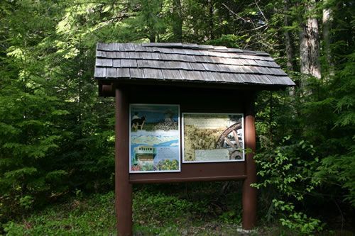
At the end of the gravel road is a clearing for parking. Park and look for the trailhead. A short 2 kilometre hiking trail takes you from the gravel clearing to a 1965 Forestry Lookout Tower. Along the hiking trail are a few interpretive signs highlighting your surroundings. Stairs lead to the top of the tower and some amazing views. In the tower is interpretive information about the area and the history of the tower.
The summit of the Buchanan Lookout is recorded at an elevation of 1,912 metres ( 6275 feet). Some of the amenities located at the summit include a picnic table, a fire pit and a pit toilet. From the lookout, there are views of the surrounding valleys and mountains including Mt. Kaslo. Powder Creek Valley, Mt Loki, Bernard Creek Valley and Kootenay Lake. On a clear day, one can see the Balfour - Kootenay Bay ferry crossing the lake.
The Buchanan Lookout Trail is popular for picnicking, sightseeing and photography. There is a short loop hiking trail located near the forestry lookout tower leading to some viewpoints situated on rock bluffs. The slanted ramps located in the area are for hang gliders. The hang gliders use the ramps for take offs.
The Buchanan Lookout Trail is best accessed in August and September because most months the snow is blocking the roads. In the winter, when the snow accumulation is high, the gravel access roads in the area are used for snowmobiling.
When traveling any of the forestry gravel roads in the province it is always wise to drive with your lights on. The rough gravel roads are also used by large logging trucks, ATVs, dirt bikes and mountain bikers. Be alert.
Buchanan Lookout Hiking Trail, Kaslo, British Columbia, Canada
Address:
How To Get ToBuchanan Lookout Hiking Trail, Kaslo
: