Parks, Trails, Beaches, Waterfalls in the Northwest Territories
Hay River NWT parks and trails in Canada. Northwest Territories parks and trails include the Hay River Territorial Park, Great Slave Lake and the Waterfall Highway.
Wood Buffalo National Park
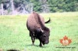
Established in 1922 the Wood Buffalo National Park is Canada's largest National Park. It was first established to protect the wild herds of wood buffalo. Today, recreation is a big park of exploring the park.
Read moreHighway #5
Fort Smith
Lady Evelyn Falls Territorial Park
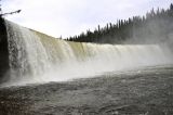
The waterfall territorial park is an activity, sightseeing and camping destination for travelers when exploring on the Waterfall Highway near the communities of Fort Providence and Hay River, N.W.T., Canada.
Read moreWaterfall Highway
Fort Providence
Range Lake Trail & Parker Park
The Range Lake Trail is a 1.2 kilometre one-way trail following the northern shore of Range Lake. The route is a multi use route visited for hiking, birdwatching in the summer and cross country skiing in the winter.
Read moreFinlayson Drive North
Yellowknife
Porritt Landing
Boat launch and day use picnic park located on Vale Island in the community of Hay River, Northwest Territories, Canada. The recreation park is situated on the banks of the west channel of Hay River.
Read moreHay River
Boot Lake and the Jimmy Adams Peace Trail
Boot Lake is a day use park popular for hiking, kayaking, sightseeing, canoeing and picnicking in the summer months. During the winter months, after the snow has fallen and the temperatures have dropped, the trail and lake become snowshoe and cross country ski destinations.
Read moreDempster Highway
Inuvik
Hidden Lake Territorial Park
The Hidden Lake Park & Reserve on the Ingraham Trail is a 3000 hectare wilderness park. It is a network of rivers, tributaries, wetlands and lakes scattered across the Canadian Shield (precambrian shield). It is home to wildlife like moose, black bear and wolves.
Read moreIngraham Trail
Yellowknife
Historical Air Freighter
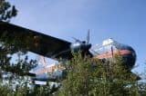
There is a large plane suspended high in the sky welcoming you to the community of Yellowknife in the Northwest Territory, Canada. The plane, is actually an air freighter - it is blue, suspended in the air on a pole and is easily spotted from the highway next to the "Welcome to Yellowknife" sign.
Read moreOld Airport Road
Yellowknife
Madeline Lake
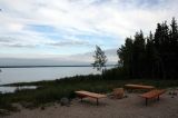
The Madeline Lake Day Use Area on the Ingraham Trail is a picnic site and a boat launch. The day use picnic area includes some picnic tables, fire pits and great views of the lake. The boat launch is used to access, both, Madeline and Prosperous Lakes.
Read moreIngraham Trail
Yellowknife
Mackenzie Delta
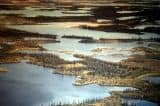
The Mackenzie Delta is a 210 kilometre wetland corridor covering over 13, 000 square kilometres. To the west of the delta are the Richardson Mountains and to the east are the Caribou Hills. In between is a maze of waterways and islands, most notably the Mackenzie River.
Read moreInuvik
Fred Henne Territorial Campground and Day Use Area
Campground and day use area
Read moreHighway 3
Yellowknife
Influencer: Error (3) Not an entry - Please, try to re-index.
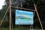
Blackstone Territorial Park
Canoe and rafting trips often put-in and take-out from the park when exploring the Nahanni National Park Reserve. The Blackstone Park is a campground destination for many paddlers who are enjoying long haul multi day paddles.
Read moreFort Liard
Tithegeh Chii Vitaii Lookout
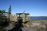
The Tithegeh Chii Vitaii Lookout includes a hiking trail and lookout platform. From the gravel parking lot follow the short 300 metre boardwalk and dirt trail to the wooden lookout peering out over Campbell Lake and the Gwichin' Territorial Park.
Read moreDempster Highway
Inuvik
Niven Lake Trail
The 2 kilometre loop trail explores the shores of a small marsh-like lake in the heart of a Yellowknife residential neighbourhood. The activities most enjoyed at Niven Lake include hiking, dog walking, jogging and birdwatching.
Read moreNiven Drive
Yellowknife
Nihtak Day Use Park
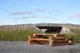
The Nihtak Day Use Park is divided into two sections by the Dempster Highway. On the north side of the Dempster Highway is a day use area with some picnic tables, fire pits and pit toilets. There is also a firewood teepee shelter which caught our attention.
Read moreDempster Highway
Inuvik
Kakisa River Day Use Area
The park is an activity destination and rest stop for travelers when exploring between the communities of Fort Providence and Hay River, N.W.T., Canada. Activities enjoyed in the Kakisa River Day Use Area include picnicking, hiking, canoeing, kayaking, boating and fishing.
Read moreWaterfall Highway
Fort Providence

